church mountain ('6100)
7/13/2014
Weather Forecast
Tue, 05.12
Wed, 06.12
Thu, 07.12
.Heavy rain along with rising snow levels Monday into Tuesday will lead to rapidly rising rivers across the area. It is likely that many rivers will reach flood stage late Monday night or Tuesday. ...FLOOD WATCH REMAINS IN EFFECT THROUGH LATE WEDNESDAY NIGHT... * WHAT...Flooding caused by excessive rainfall continues to be possible. * WHERE...Portions of northwest and west central Washington, including the following counties, in northwest Washington, Clallam, Grays Harbor, Island, Jefferson, Kitsap, Mason, San Juan, Skagit and Whatcom. In west central Washington, King, Lewis, Pierce, Snohomish and Thurston. * WHEN...Through late Wednesday night. * IMPACTS...Excessive runoff may result in flooding of rivers, creeks, streams, and other low-lying and flood-prone locations. Flooding may occur in poor drainage and urban areas. Low-water crossings may be flooded. Extensive street flooding and flooding of creeks and rivers are possible. * ADDITIONAL DETAILS... - Excessive rainfall Monday and Tuesday with 7 to 10 inches possible over the Olympics, 5 to 9 inches over the Cascades, 3 to 5 inches along the coast and 1.5 to 3 inches over the interior lowlands. Snow levels will rise to around 9000 feet Monday night before dropping Tuesday. - http://www.weather.gov/safety/flood
(NWS Seattle (Northwest Washington))
...HEAVY RAINFALL TODAY THROUGH TUESDAY NIGHT WILL LEAD TO AN INCREASED THREAT OF LANDSLIDES IN WESTERN WASHINGTON... Rainfall of 1 to 5 inches over the past 3 days has increased soil moisture to moderate levels across western Washington. Heavy rainfall of 2 1/2 to 5 inches is expected today through Tuesday night. This amount of rain will put extra pressure on soil instability, leading to an increased threat of landslides and debris flows. For more information about current conditions, visit www.weather.gov/seattle, select Hydrology, and then scroll down for the links to the landslide information pages. For more information on landslides, visit the website for the Washington State Department of Natural Resources landslide geologic hazards at: http://bit.ly/2mtA3wn
(NWS Seattle (Northwest Washington))
Gaia Map
Approximate Route Map
The activities depicted on this site are inherently dangerous and can result in serious injury or death. Any action that you take as a result of information obtained from this site or any information provided through Hike2Hike is at your own risk.
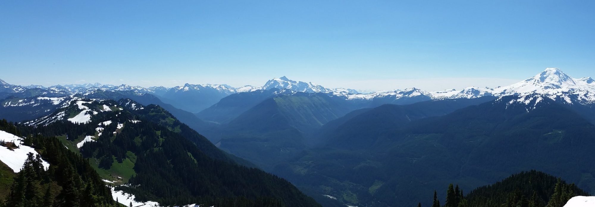
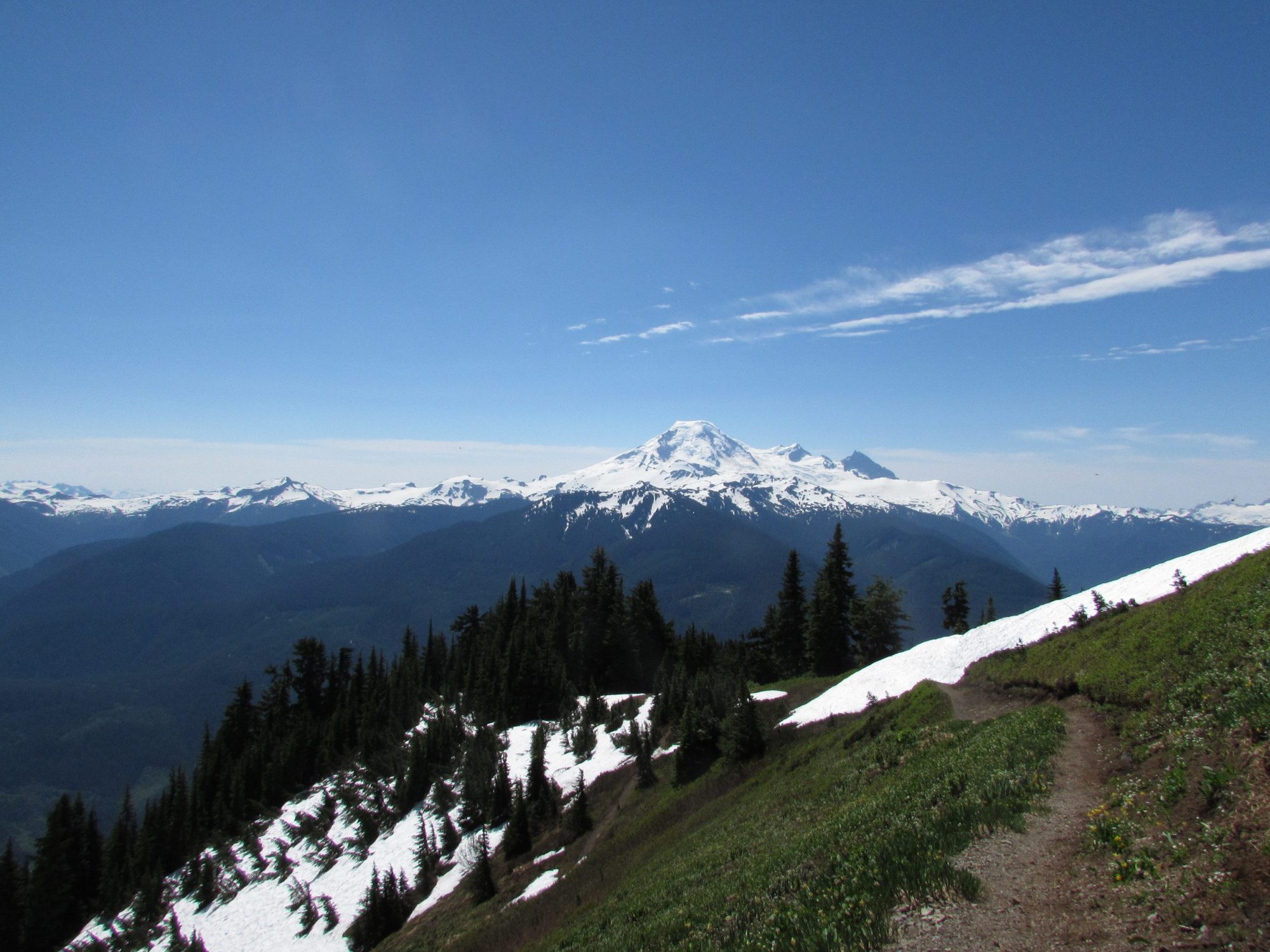
Now out of the trees, the view improves with nearly every step. It is something that must be experienced to understand. All I can say is that the mountain is aptly named. Anyone who chooses to climb up church mountain’s steep slopes will be rewarded with some astonishing views of the North Cascades.
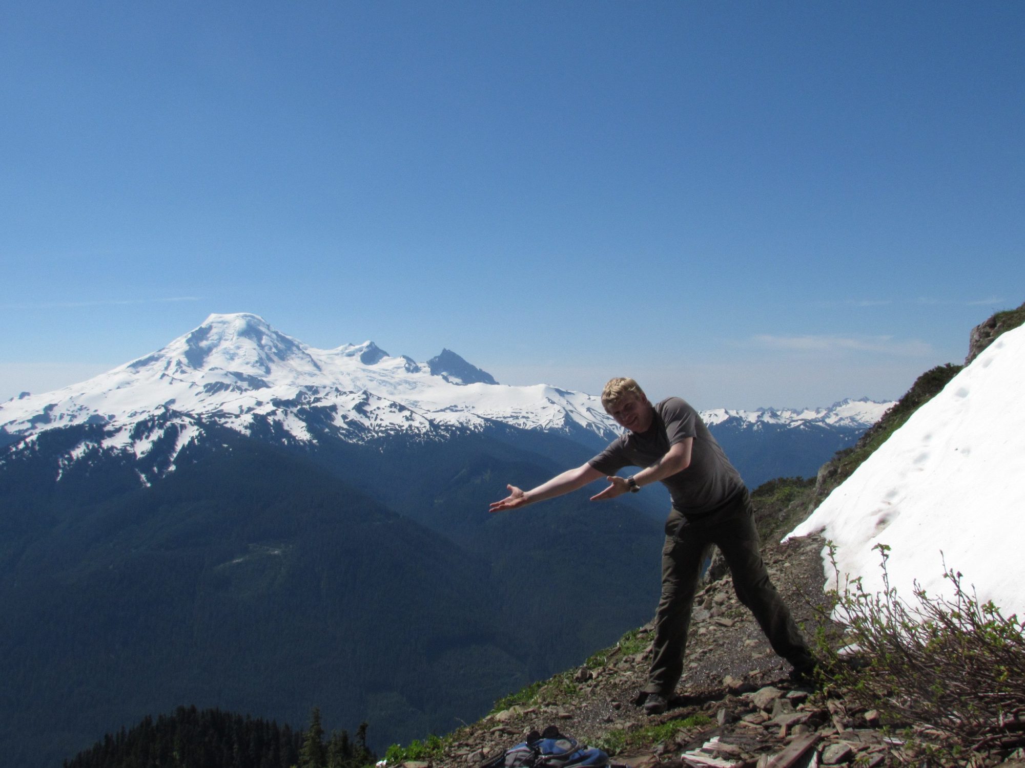
When you reach the end of the Church Mountain trail, you can choose to stop and take in the exceptional views, or if you choose you can continue on a little ways and then scramble to the actual summit (6100 ft). From here you can see well into Canada and will have a 360-degree view that is hard to beat.
The trail up Church Mountain is long, steep and at times, discouraging. It starts off from the parking lot on an old road. After a quarter-mile it turns and begins the climb. Through thick tree cover the trail climbs up switchbacks and provides no views as a distraction. This first portion of the Church Mountain trail is unappealing and mind-numbing. However, for those who can push through the monotony of it will certainly reap their reward.
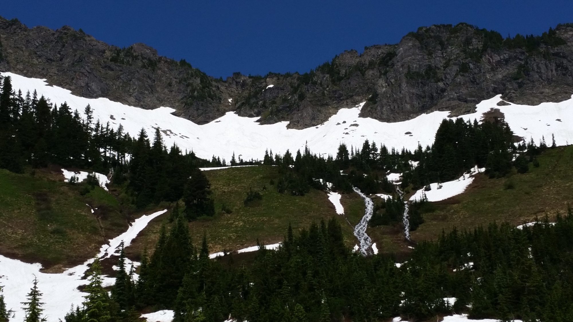
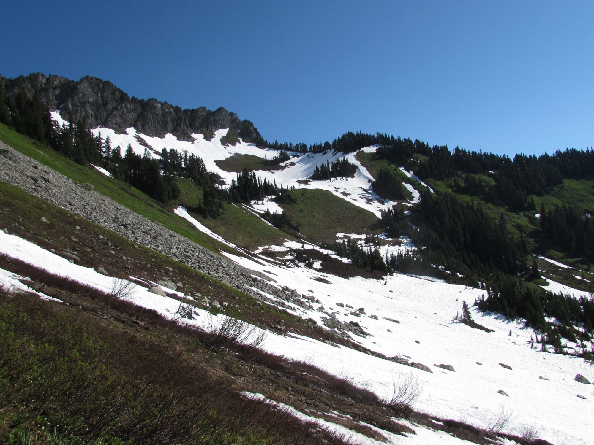
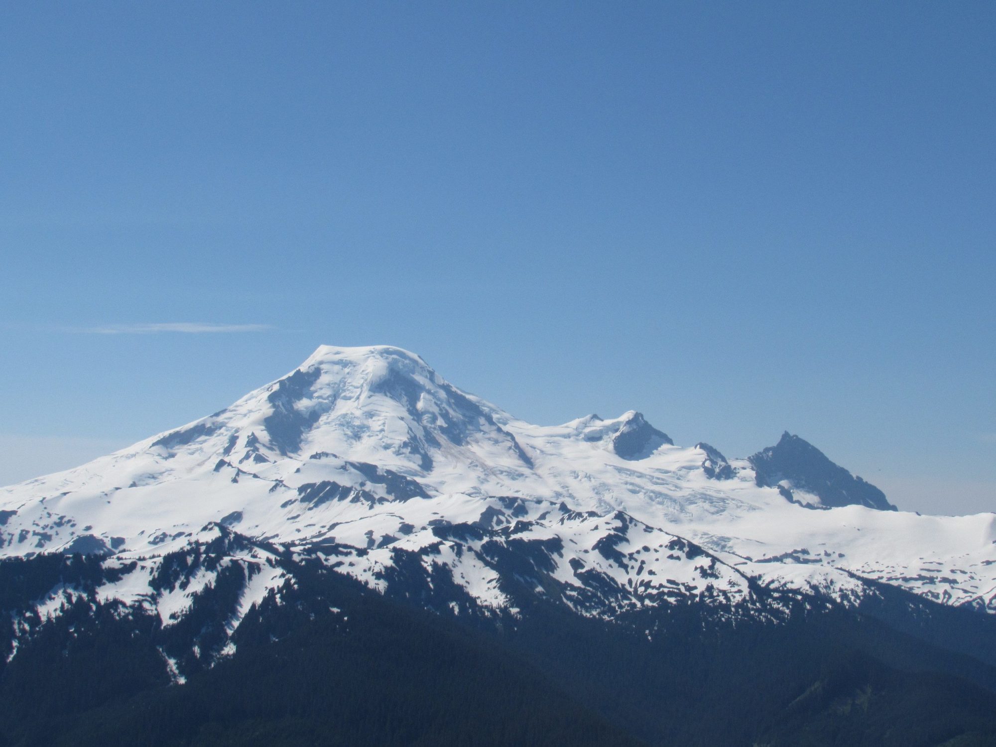
Once you break out of the trees around 5000ft you get your first glimpse of Church mountain’s SE face. When you get to this point, look to your left for your first glimpse of Mt. Baker. As you walk through the meadow and towards the last few switchbacks remember to keep glancing to your left for more views of Baker and Shuksan. The first meadows are spectacular and a nice short reprieve before climbing the last few switchbacks.