


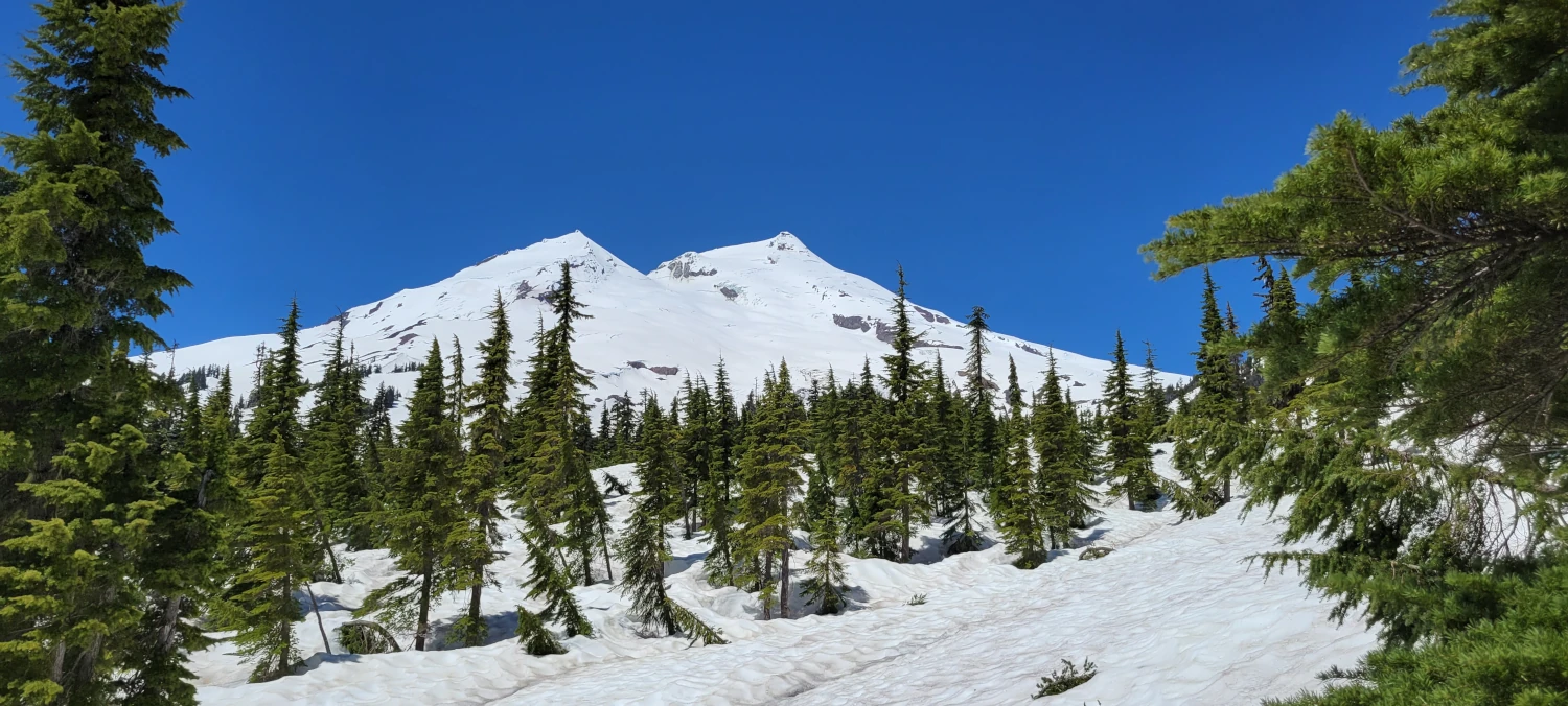
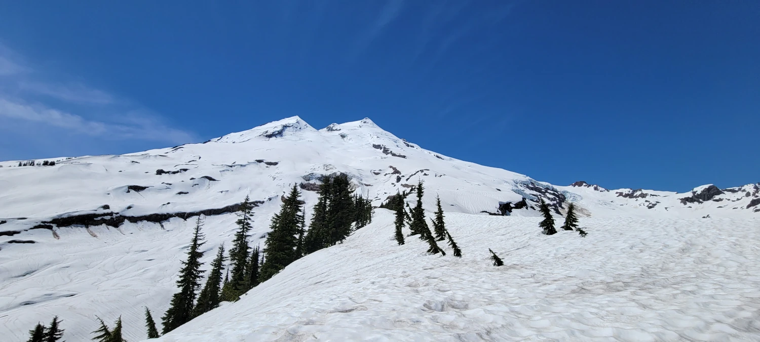
Mount Baker will always be one of my favorite climbs. It was the first peak I summited over 10,000 and has one of the best views of all the peaks I’ve summited. The only one that could beat the view in my climbing experience is Eldorado peak.
While it is a yearly ascent for me at this point, the route I prefer to use would be a disaster this year. The road up to the climbing route for the Coleman Deming route had washed out, shutting off access. That meant the Easton Glacier would bare the brunt of the climbing parties.
This time Trailcutter and I were the only two on the team. So, I proposed a few routes along Mount Baker’s other flanks for her to choose from. She picked the Boulder Glacier route on Mount Baker’s east slope. I had read about the Boulder Glacier several times, but this was the first time someone wanted to try it with me.
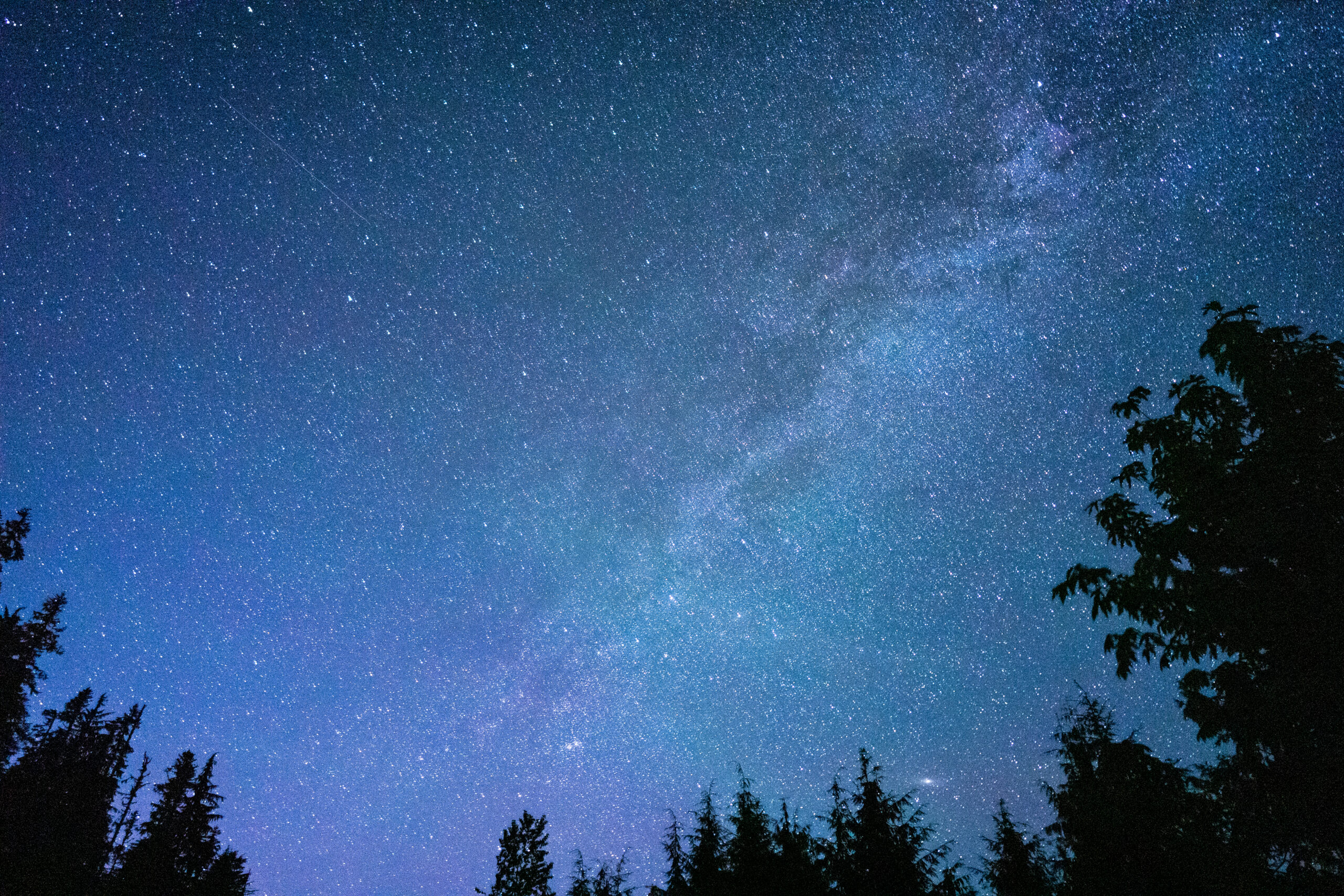
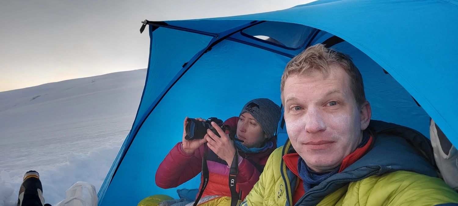
We arrived late at night on Friday. Driving forest roads 1130 and 1131 in the dark was an adventure. It was clear barely anyone ever ventures up this way. After some nighttime photography and a decent night’s sleep in the parking lot, we were ready for the mountain.

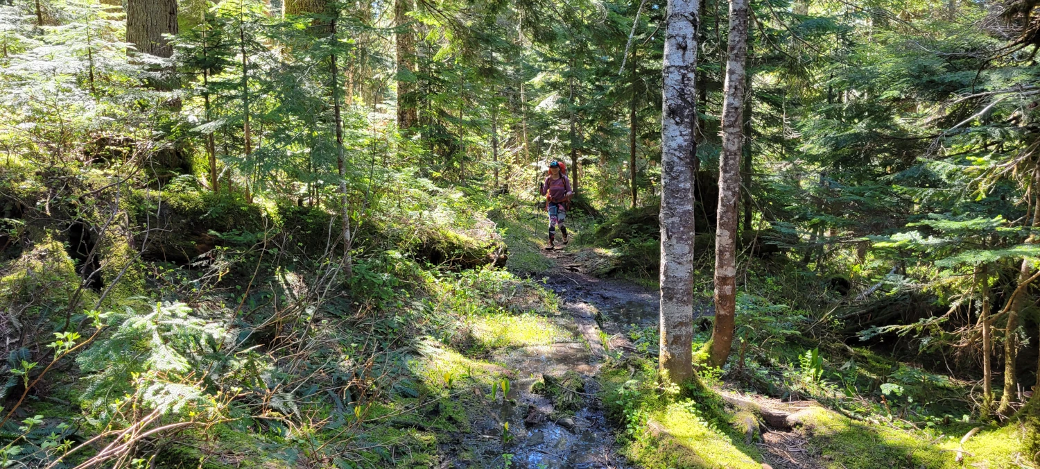
The first 1.5 miles up Boulder Ridge trail is a gentle walk over even ground. There were some blow downs and a little brush to press through. But despite the lack of trail maintenance, it was easy to follow.
Our first challenge of the trip came when we reached the point where the Boulder Ridge trail crosses over the creek. I approached the stream, but it looked like the path had disappeared and did not continue. We agreed as a team to attempt working our way uphill and started bush-bashing up a steep slope alongside a small stream. The brush here was thick, and the hill’s slope was steep. It took us over an hour to barely a half mile. At that point, we decided to head straight across and hoped we found some trail.

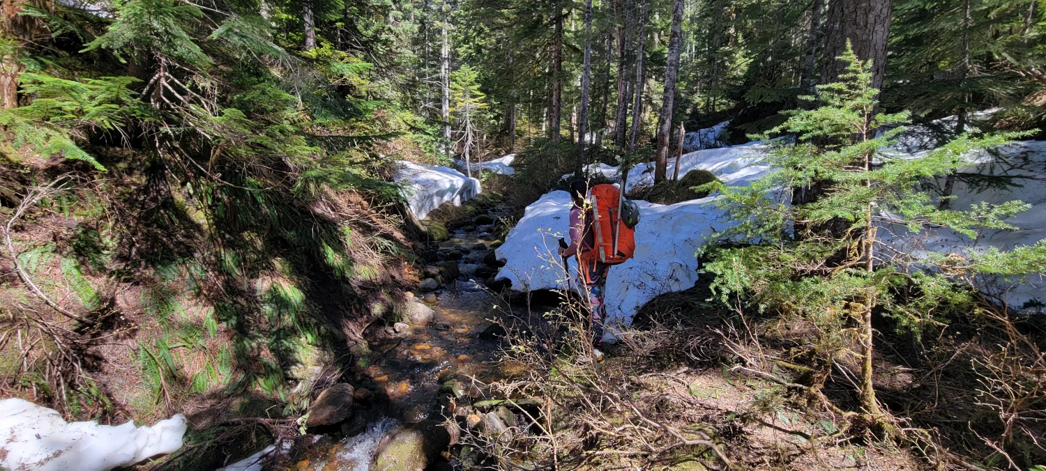
After about 30 minutes of working along the side of the hill, we heard other voices and saw several skiers working their way uphill on snow. Delighted, we headed for their track to see what we could work out to get up the mountain.
Once we reached their track, the route improved, and we were back to an average pace again. We learned on the way down that a distinct climber trail continues after you cross the creek low down on Boulder Ridge Trail. When you reach the creek crossing, cross the stream, and the climber trail is obvious.
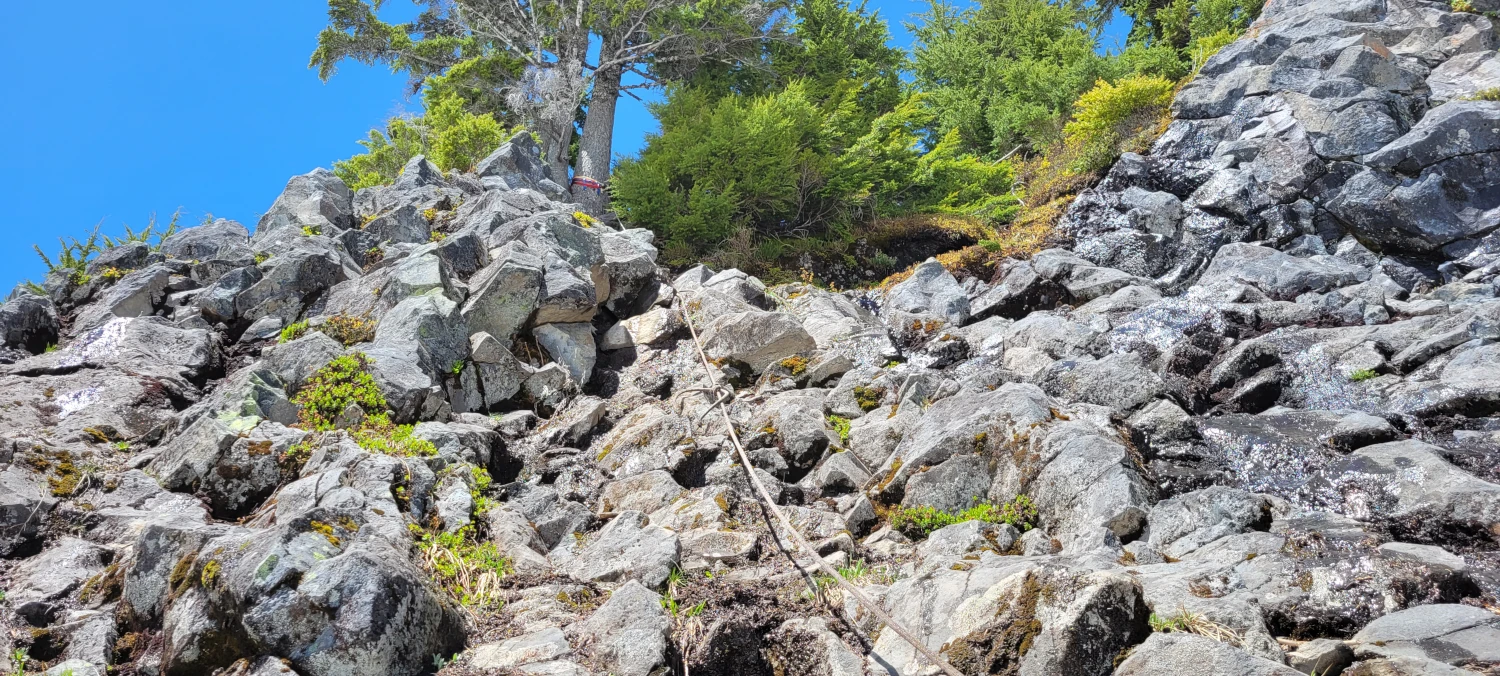
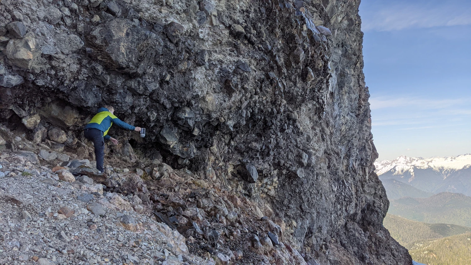
The remainder of the way to the cliff section was a smooth walk up to the bottom of the roped area. Before setting off, we read that the cliff section to make it to the ridge proper is around 75 feet. Due to the snow year we were having and the time of year we were headed up, the snow was high enough that the ascent was cut down to around 40 feet. However, there was a significant moat to work across to make it to the fixed rope. The skiers we started following earlier turned around at this point to ski back to their cars.
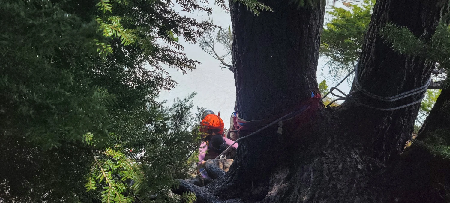
Once we found a spot to cross the moat, getting up the cliff was easier than I had anticipated. There is a fair number of good handholds. The one tough place is at the top when you must work under several trees and over a large root. It would be a breeze without a pack on, but it was a challenge with our large glacier-ready bags.
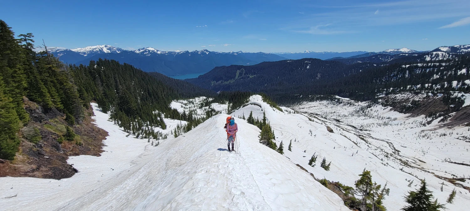

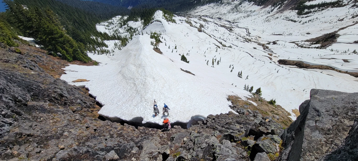
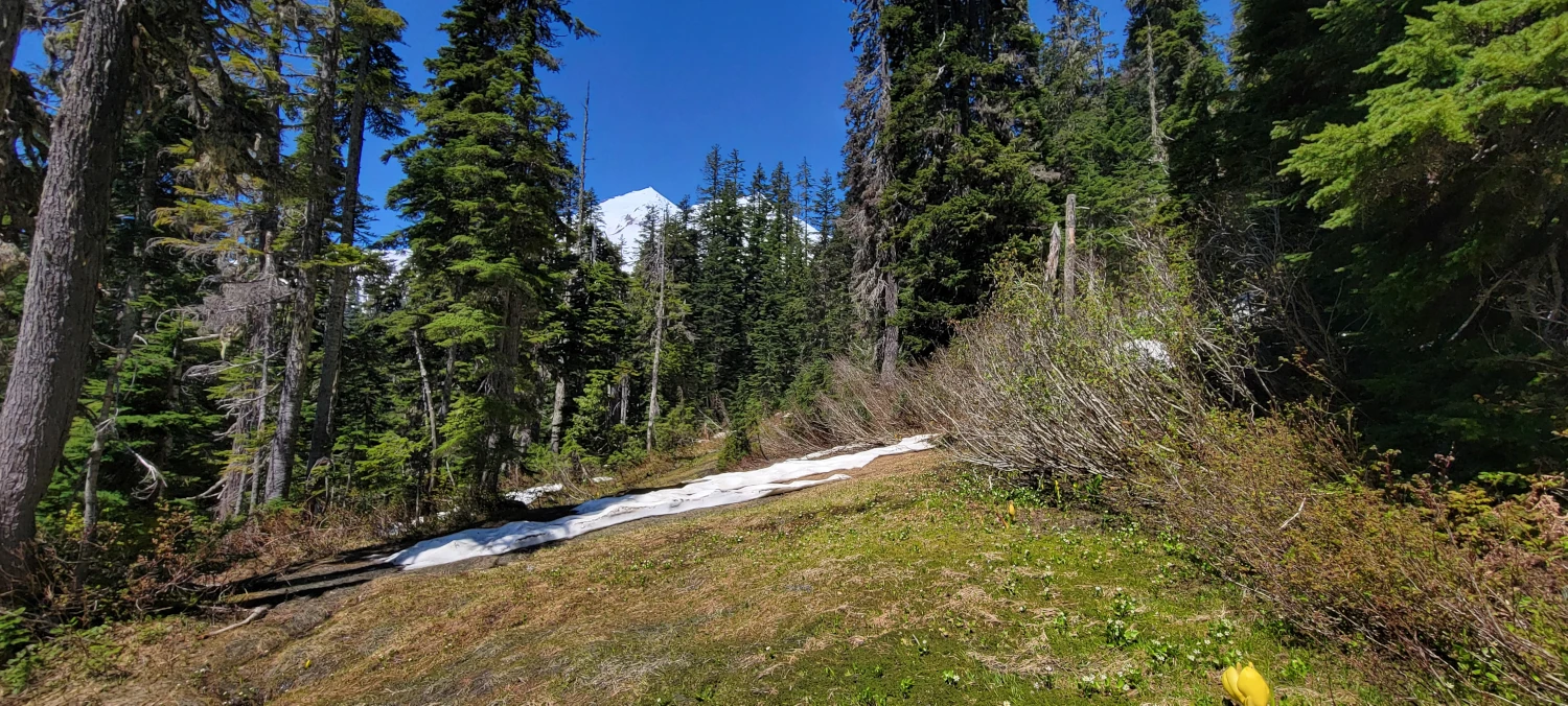
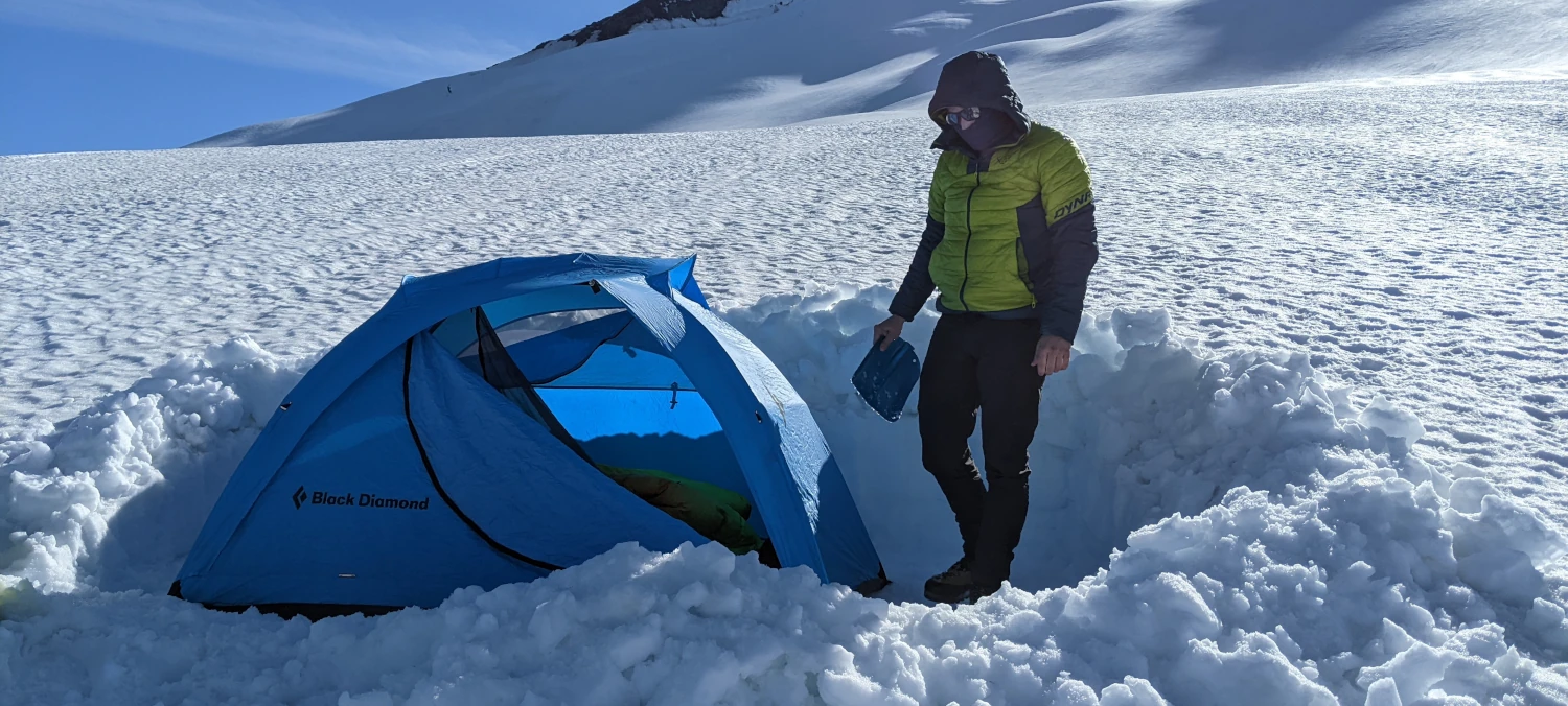
We gained the ridge from the top of the rope, and it was a quick hour or so to where we set up camp. A note on camping, I read about multiple spots to set up a camp once you get past the fixed rope/scramble section. We chose to get close to the cleaver at around 7,500 feet to make for a shorter summit day. The only other group on the peak for the day decided to stay closer to the middle of the ridge. Either way, the views will be unbelievable.
While setting up our camp, the shovel I brought snapped off at the handle. We attempted to patch it with some rope and medical tape, but unfortunately, it came apart again. So we dug out a tent space with just the shovel end and no handle.
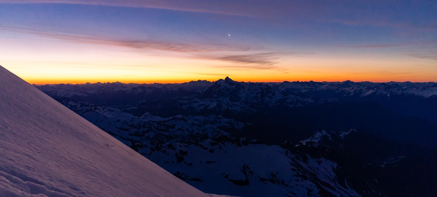
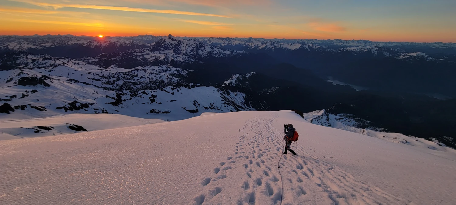
The sunset from our camp was out of this world. After digging in, eating, and setting up our beds, we sat our mouths agape, watching the last bits of sunlight dance across the North Cascades. Definitely one of my favorite sunsets I’ve seen.

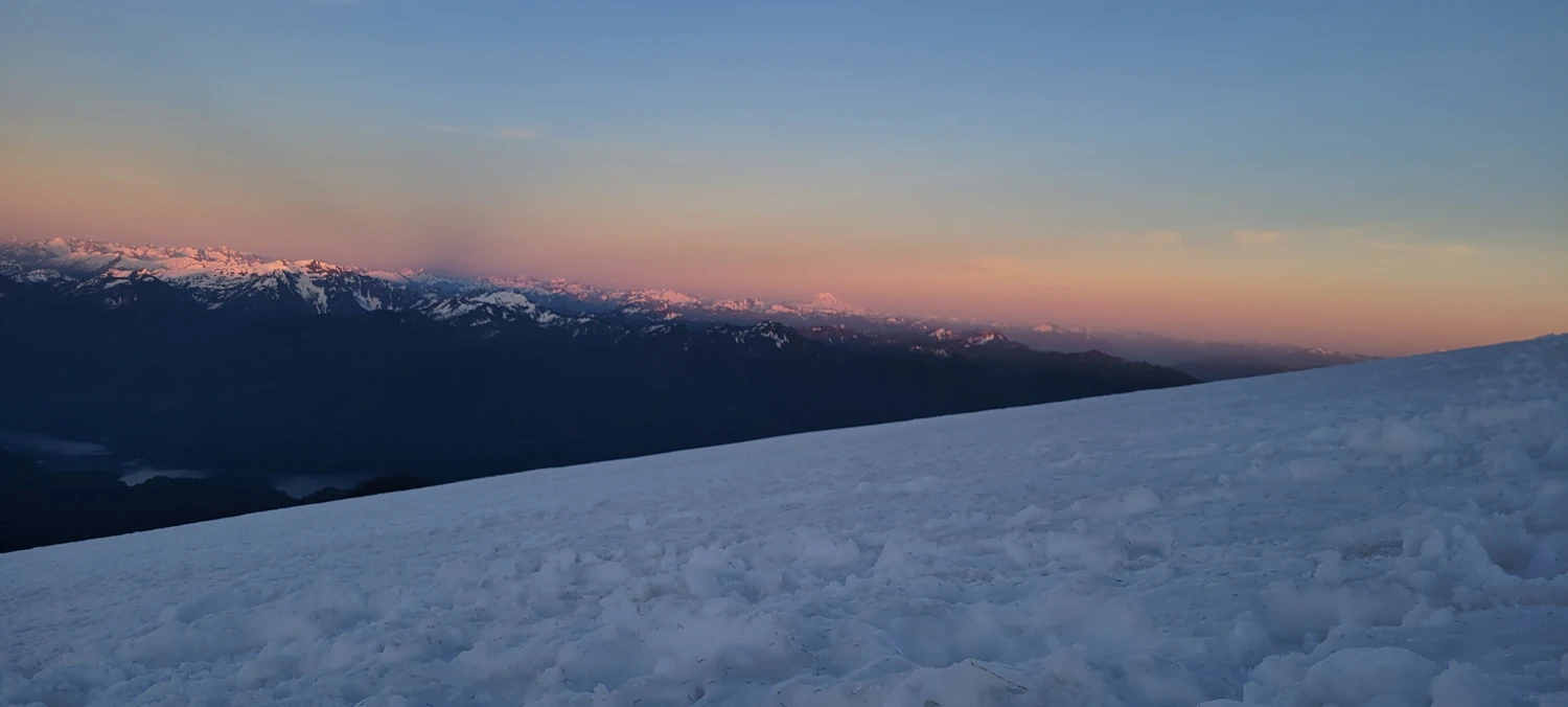

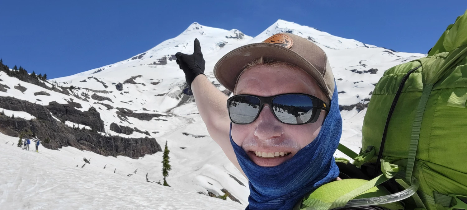
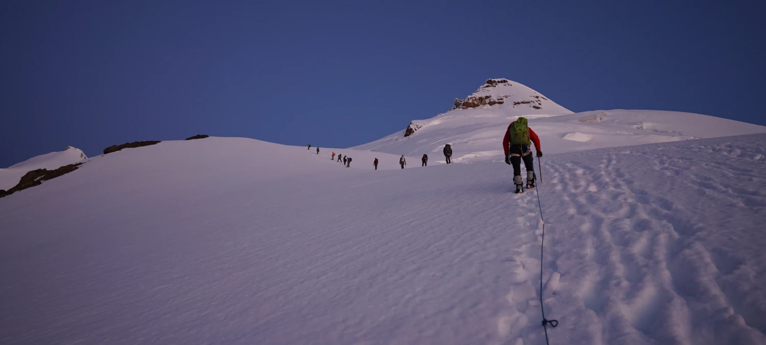
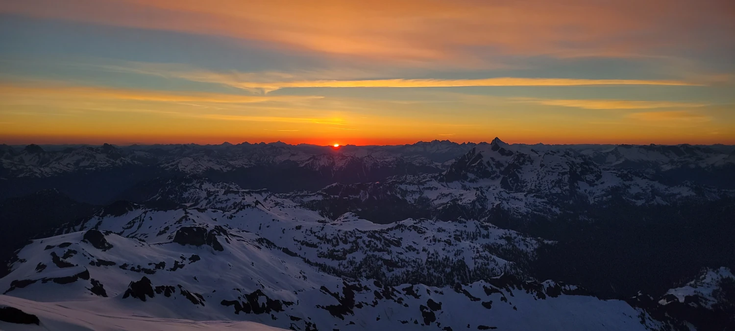
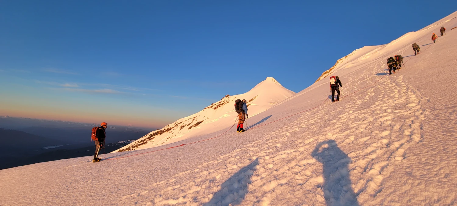
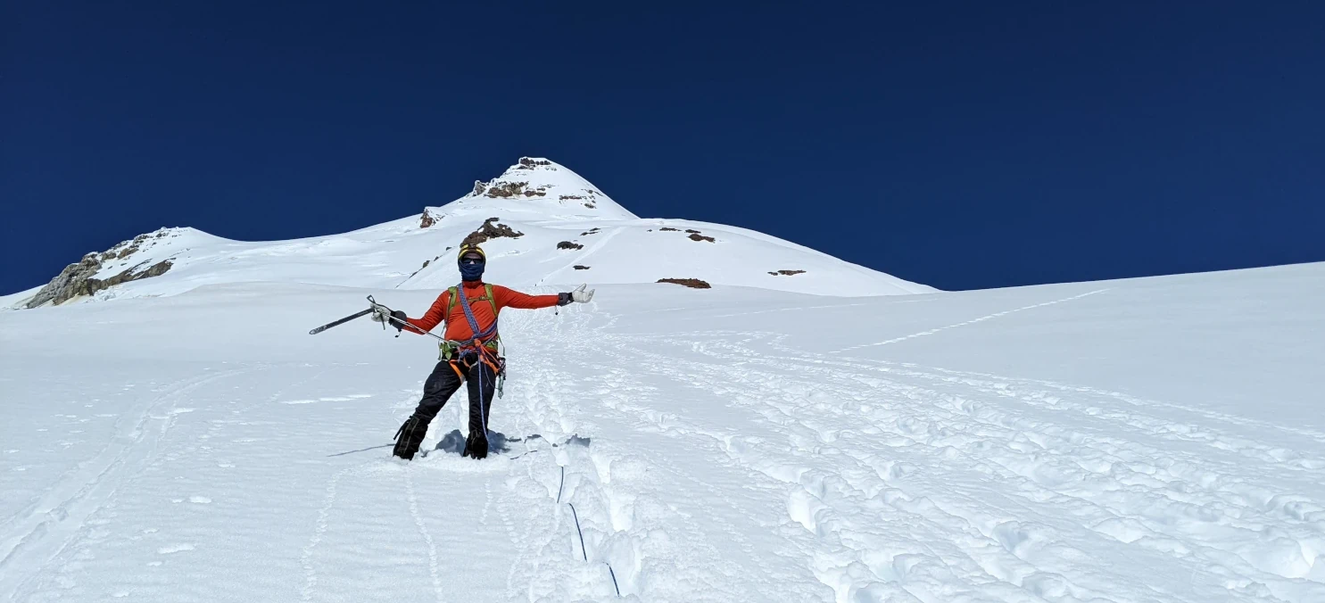
We woke up around 1 am to make our summit bid, ate breakfast, roped up, and started to slog uphill around the cleaver. Compared to the Easton Glacier Route, the Boulder Glacier is a monster. From the very start, it climbs straight up the side of Mount Baker. The incline made us move slowly, and our pace was slowed further by frequent stops to gawk at the sunrise. The twilight hours on the Boulder Glacier route are something to behold.

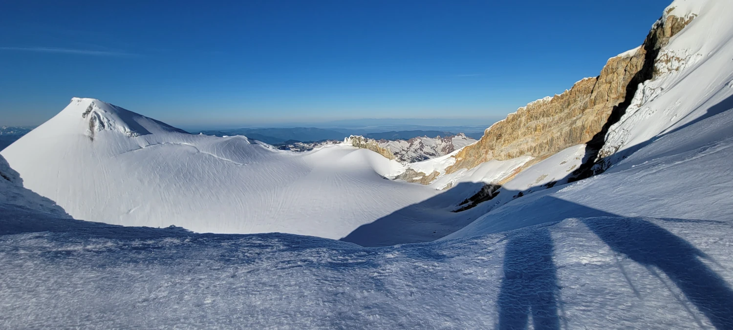
As far as the climb up the Boulder Gacier goes, it is a straight, steep walk up the side of mount Baker for hours on end. The views take the breath out of you, so be sure to turn your head anytime you feel a little burn. The Boulder Glacier route only requires minor technical skills. But those views of Shuksan and up to Canada, oh my. I could not get enough.

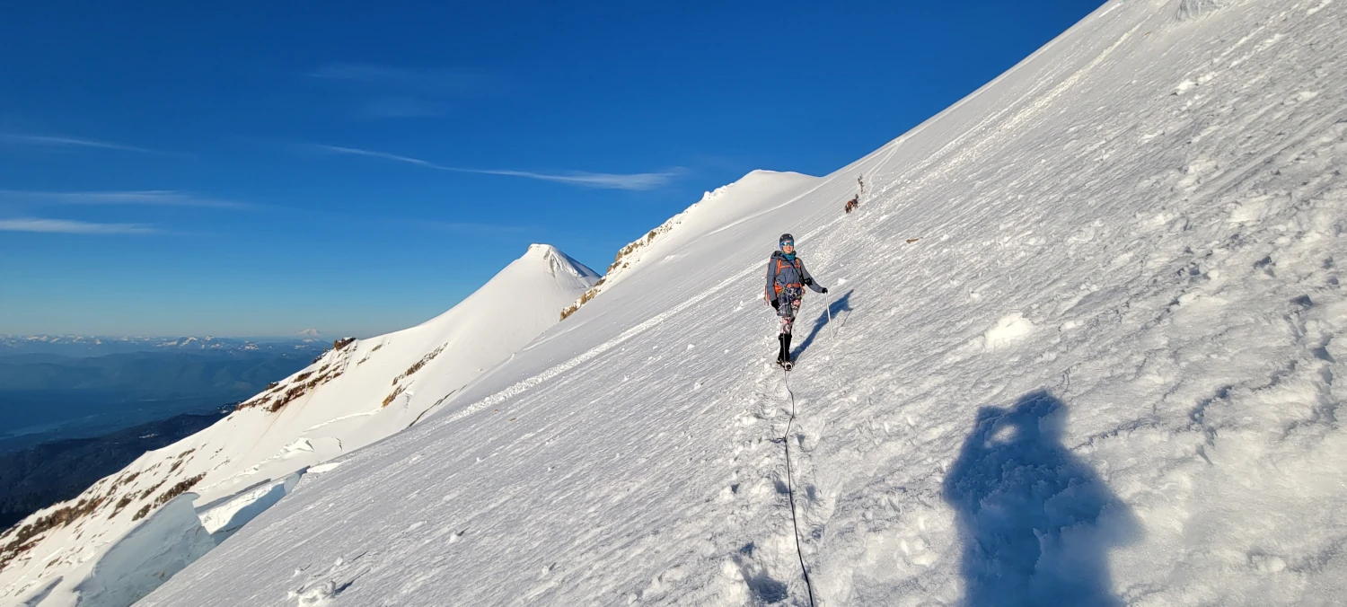
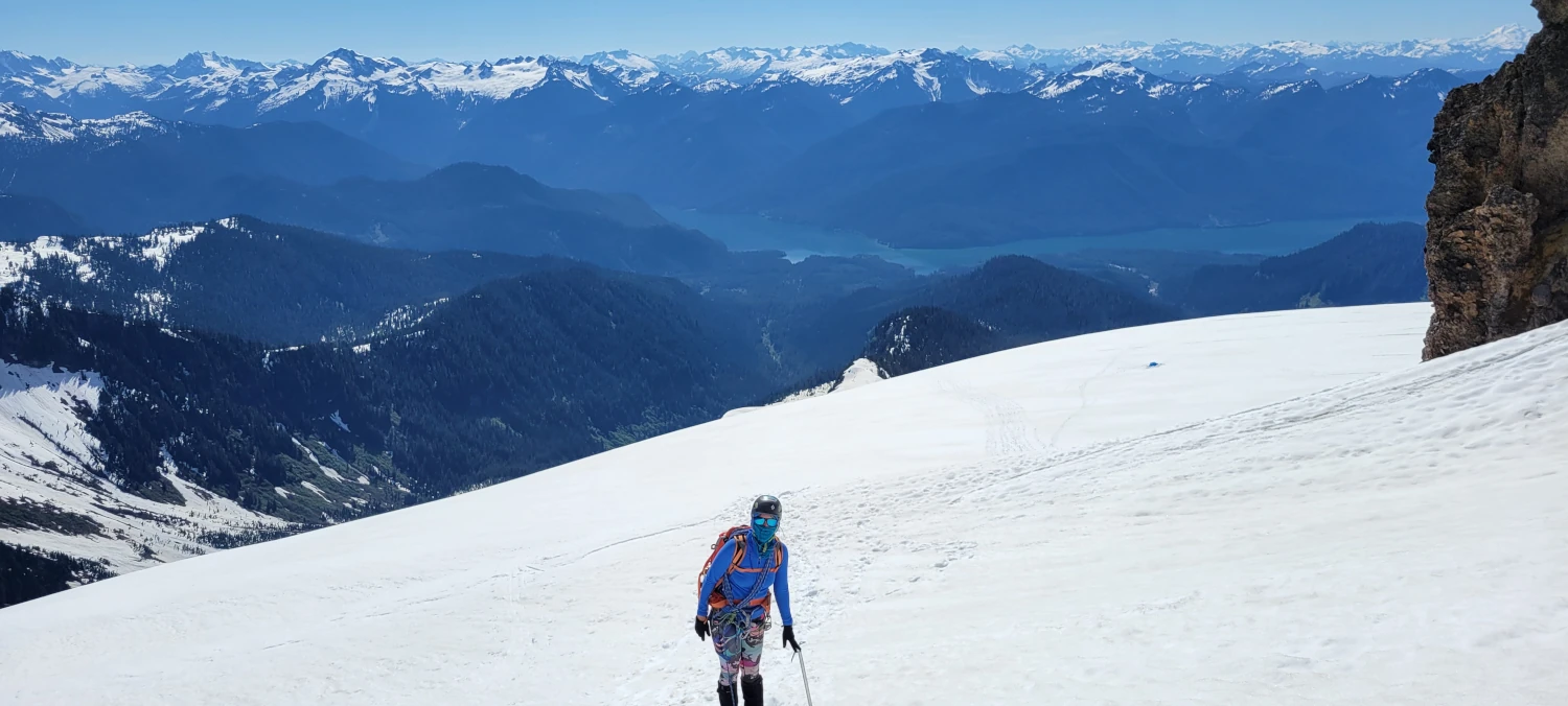
When we reached around the 9500 ft level, Elena and I felt dizzy and weak from the altitude. Leaving Lahar Lookout, the summit appeared to be only an hour away, but it took us around two hours to reach the summit plateau. Every bit of the last stretch hurts. The Boulder Glacier does not relent at any point.
It is hard to describe how steep the route is. One will only find out by walking it.
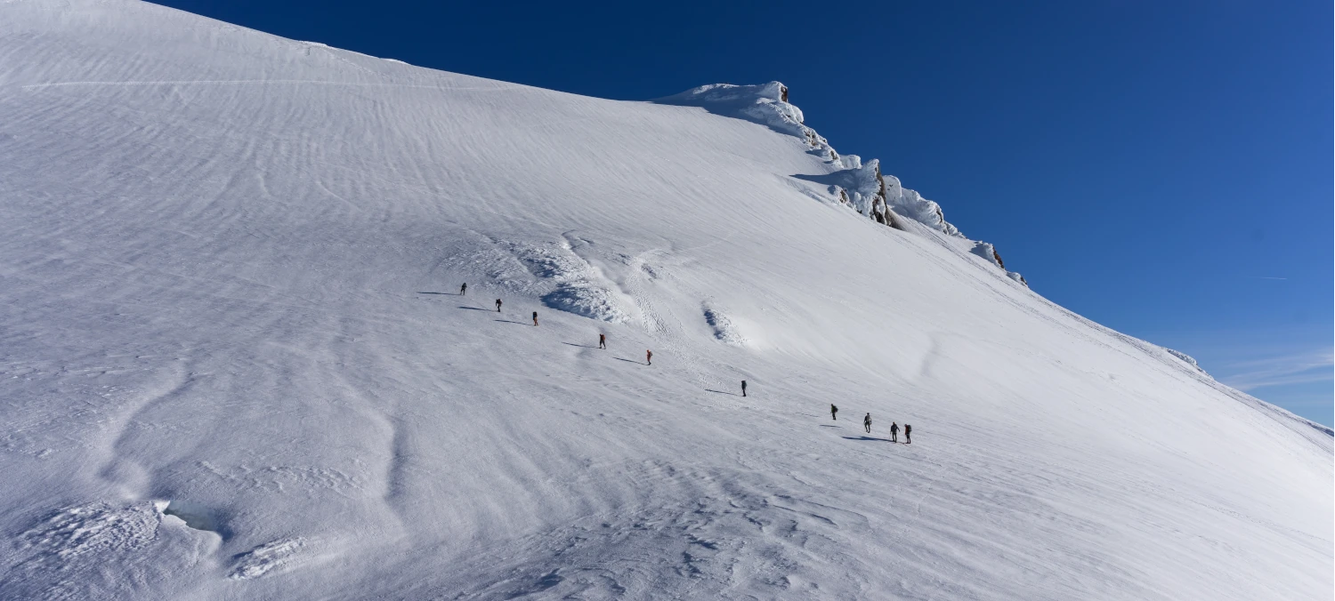
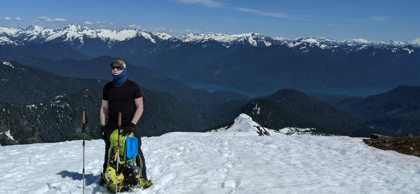
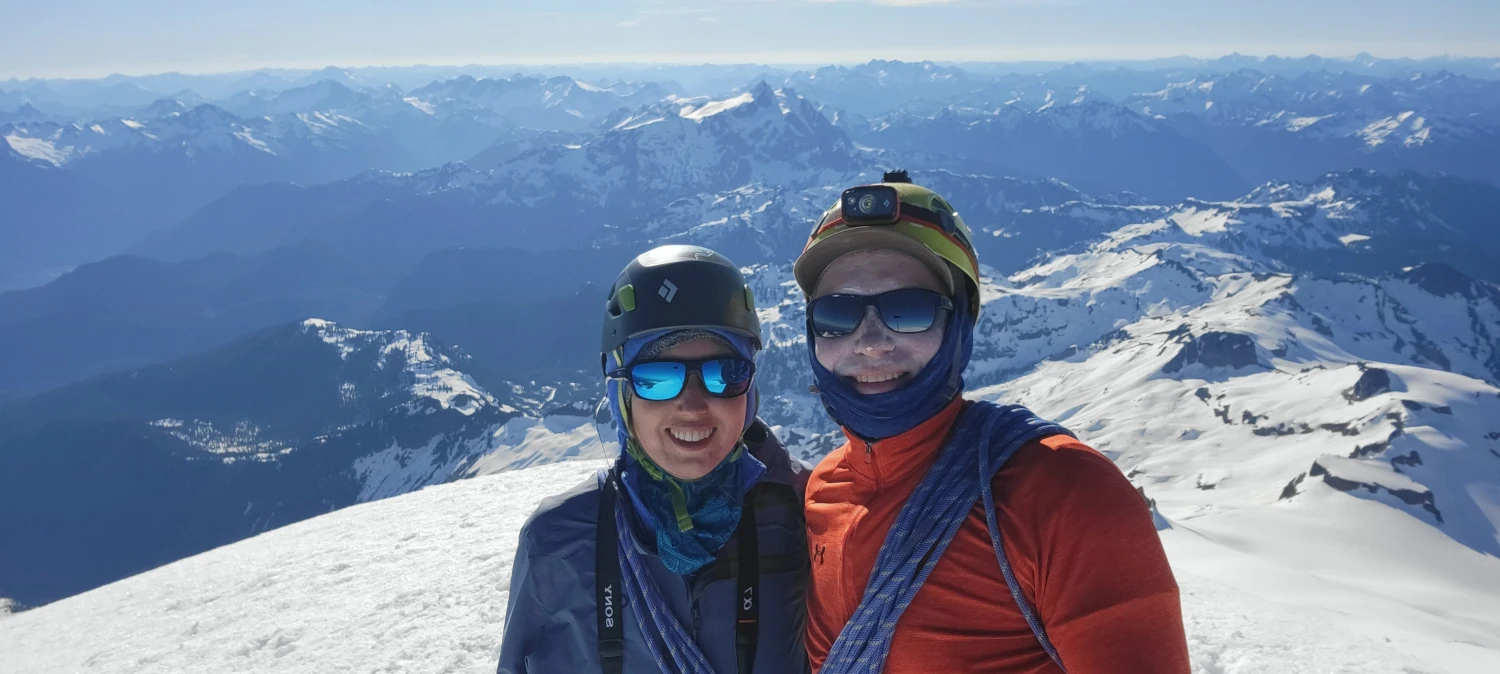
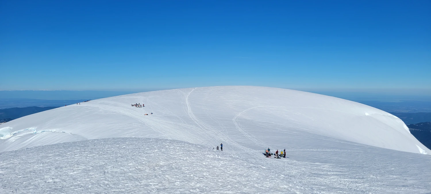
At the summit plateau, we snapped a photo and ate a snack. While munching on our energy foods, I watched the line of climbers ascending the Easton glacier. Due to that road closure, it appeared nearly everyone had taken the Easton glacier route. The line of climbers was endless. The summit plateau was extremely crowded, and after the almost human-deficient climb up the Boulder Glacier route, the scene felt suffocating.
Due to rapidly rising temperatures, we headed for camp after just a few minutes on the summit plateau. The high for the day was projected to be around 45F on the summit, and a glacier is no place to be when there is a distinct possibility of melt.
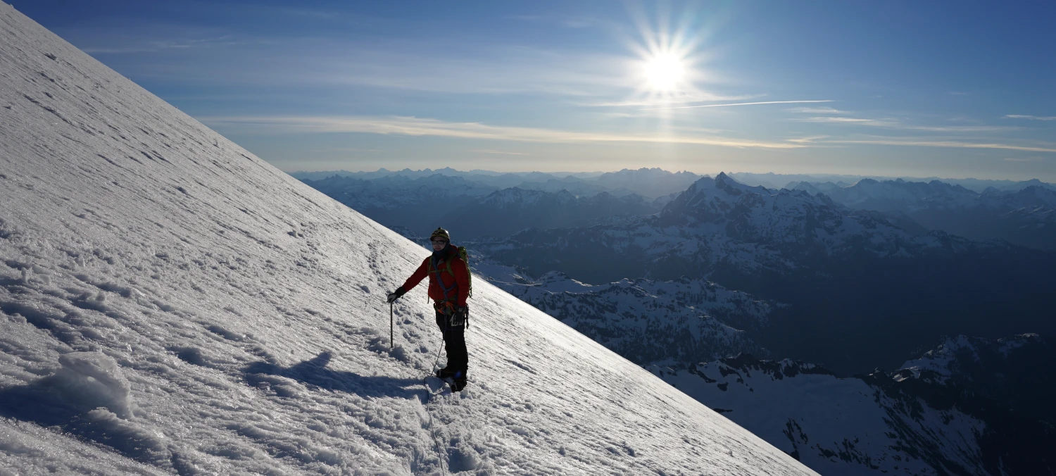
The descent was where I learned not to like this route. Only two other rope teams made the summit that day with us. However, they were moving extremely slowly. With the rapidly rising temperatures, I could only think about getting off the upper glacier and back to our tent, where there was some modicum of safety. Unfortunately, the Boulder Glacier route’s steepness leaves little in the way of a passing lane to get around slower climbers.
We made it around them and down to our tent without problems. But if I were to climb the Boulder Glacier route again, I would ensure plenty of space between my party and others on the climbing route.
The last challenge on the way down was getting through the rappel section, where the scramble section was on the way up. Getting back down over the tree root and to the rope was challenging. But, once again, it would be a breeze without a pack.
The heavy bags on our backs made for a few exciting moments trying to exit the ridge line. I attempted to put a prusik onto the rope and take our packs to safety so it would be easier to descend and get to the rope. After I secured myself to the rope, Trailcutter handed me her pack. I made it to the bottom and could not reach over the moat. So, I decided to toss the bag over to the snow. Unfortunately, the pack landed on the snow, bounced, and rolled several hundred feet down the mountain. Not the best idea I’ve had. I had to work my way down to where it was and reascend with it.
Climbing the Boulder glacier route is not for the faint of heart. There are navigation issues, and in most years, there is a good chance you will be alone. So, if you decide to walk the route, make sure you have solid glacier skills, bring your optimism, and a quality camera.