I set out to climb Eldorado Peak in the North Cascades National Park since. it is one of the last few still accessible portions of the park during the fall of the year. It is also a Bulger Peak. But, fall tends to be my least favorite season for climbing here in the pacific northwest. You can check the weather, plan for the possibilities and somehow the Cascades seem to still find a curveball. Yet, The weather report remained constant for the entire week. So I set out with far more confidence than I should have allowed myself.
According to the trail reports I could find for Eldorado Peak, there is a large log used for crossing the river. But, that base of instructions for the east ridge trail broke down once I arrived at the trailhead. I am not sure if the river had changed course, or if there was some intentional changes made to the layout of the road. Either way the large log that everyone mentioned was missing.
If you are looking for a way across, park at the parking lot and head straight towards the river. There is an obvious trail through the brush and then do what you can to locate a crossing point. Many spots looked easy to wade through if it is summer. But being fall the water seemed too cold for that.
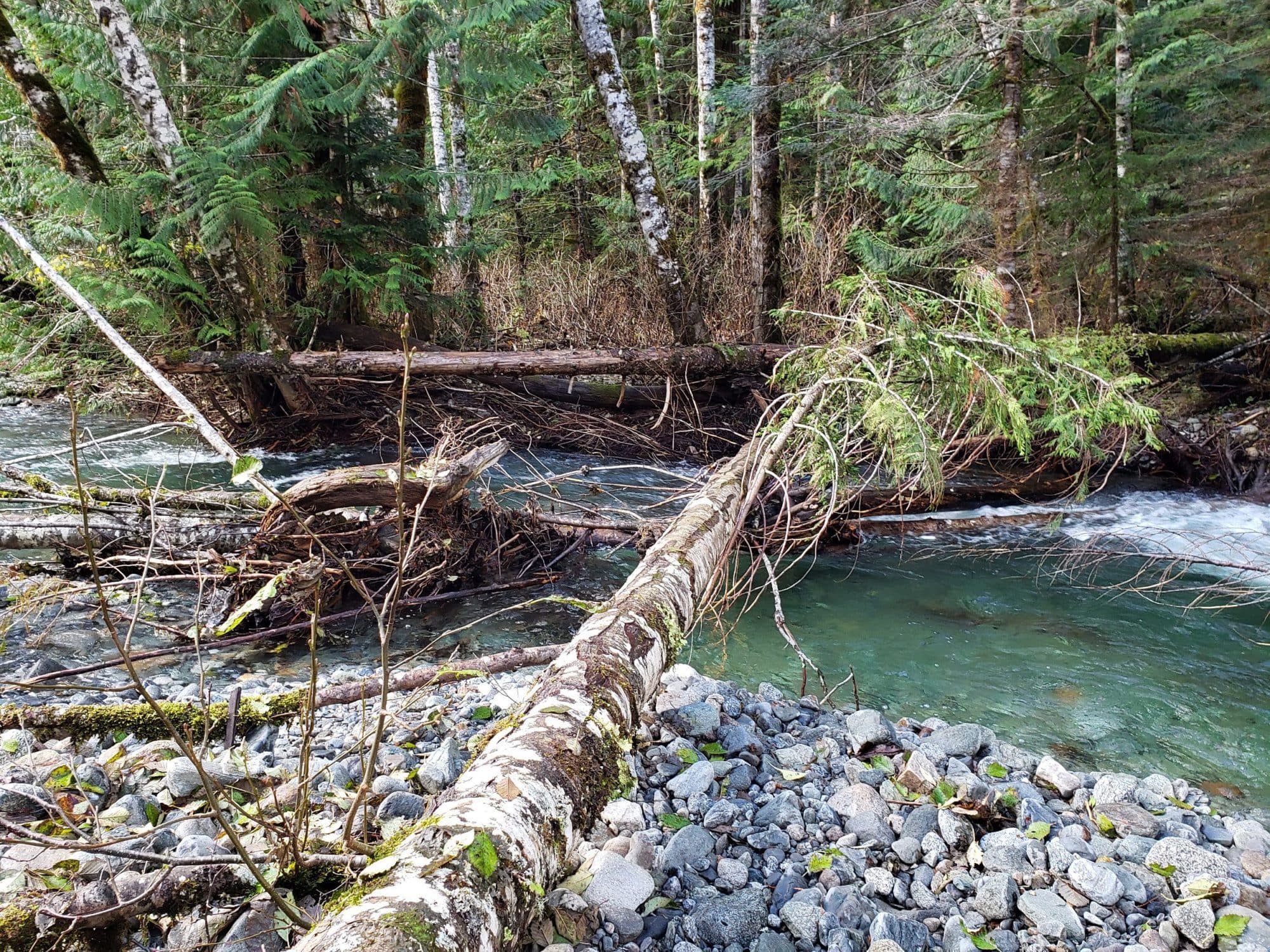
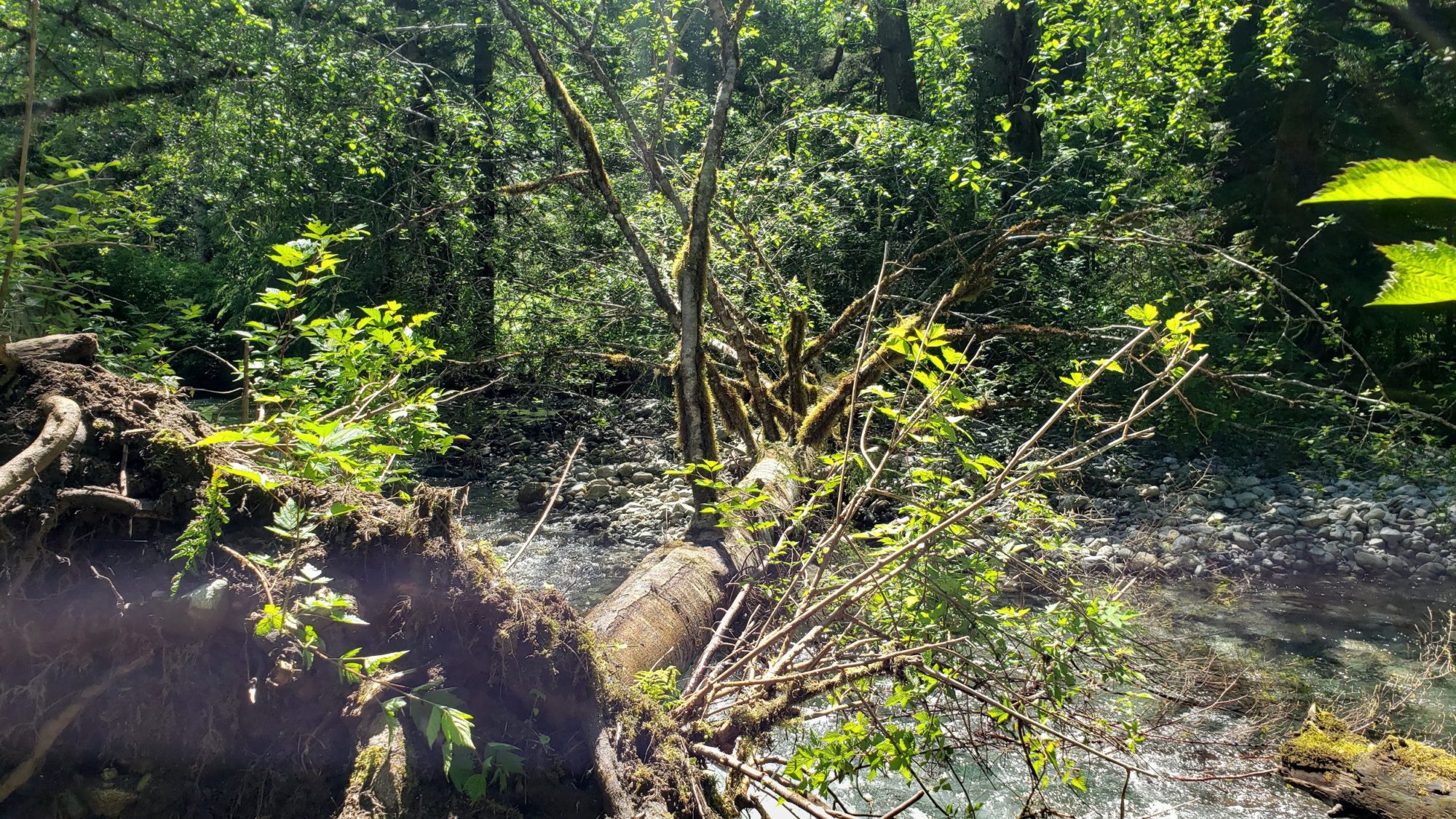
After half an hour of searching for a way across the river I settled on a small log (pictured above) that I located. It was slick, tiny, and not ideal but it worked. Once across the log it was easy to locate the sign indicating the start of the Eldorado Peak climbers trail.

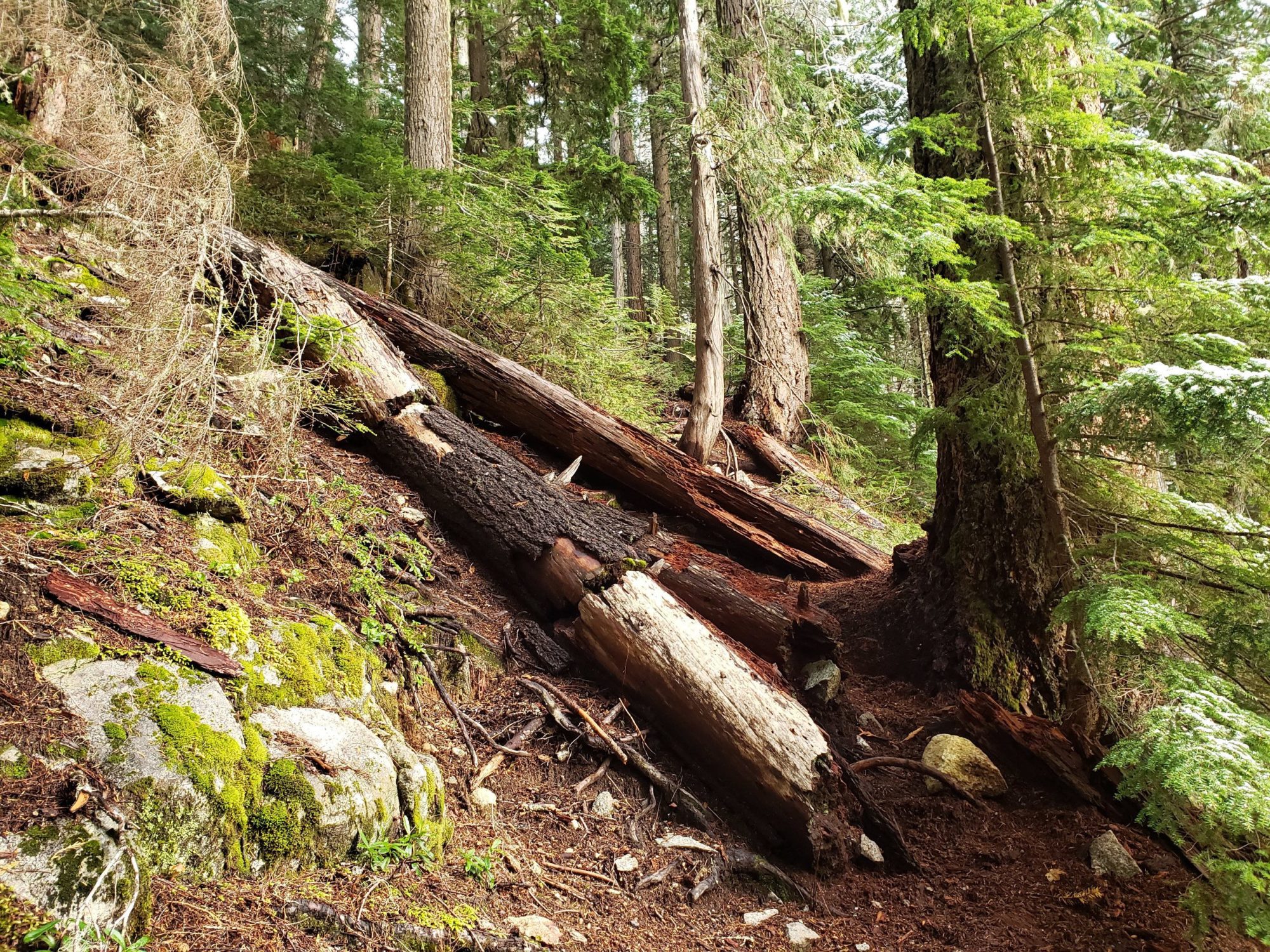
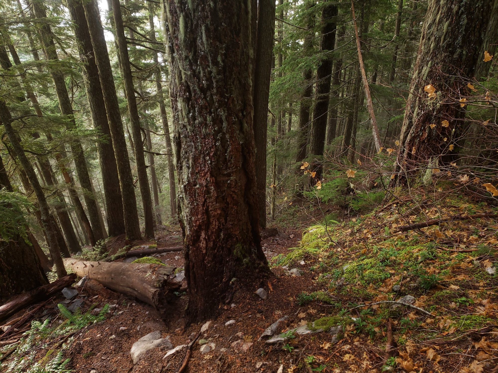
The trail up the first hill is unremarkable but incredibly steep. Prepare for a few hours of drudgery. Try to do it in the dark so you can leave the daylight for the actual climbing. The real fun will start once you have reached the boulder field around 4,000 feet.
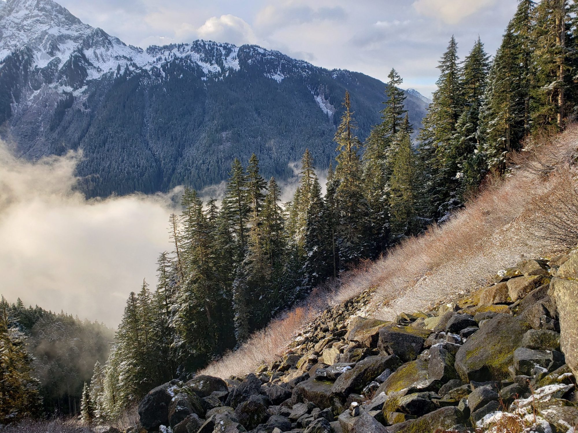
The first section of the boulder field was easy to navigate despite the fact that many of the rocks had iced over. It was the second half where things started to get a little hairy. Due to the snowfall from the year there were several inches of snow covering the boulders and the gaps between them. For an hour and a half I tried and failed to scramble across the rocks and instead was post-holing between them. All around this section felt like a nightmare.
After reaching the area where the waterfalls are and managing to find a way across them the day only got even rougher. The snow became several feet deep. Most days this would have been of no issue, but there were two distinct layers. The top one had formed an ice structure and was worthy of crampons while the bottom layer was weak and powdery. Every time I stepped I would feel secure and as soon as my body weight would shift to my foot I would posthole up to my waist. I thought many times that I should have brought snowshoes. My climb of Eldorado peak was looking less likely with every step.
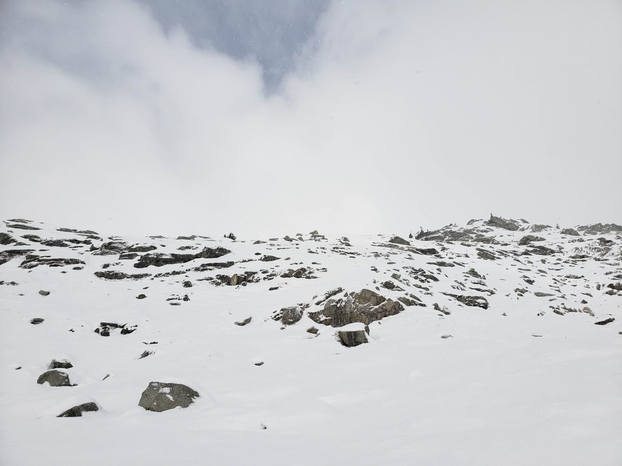

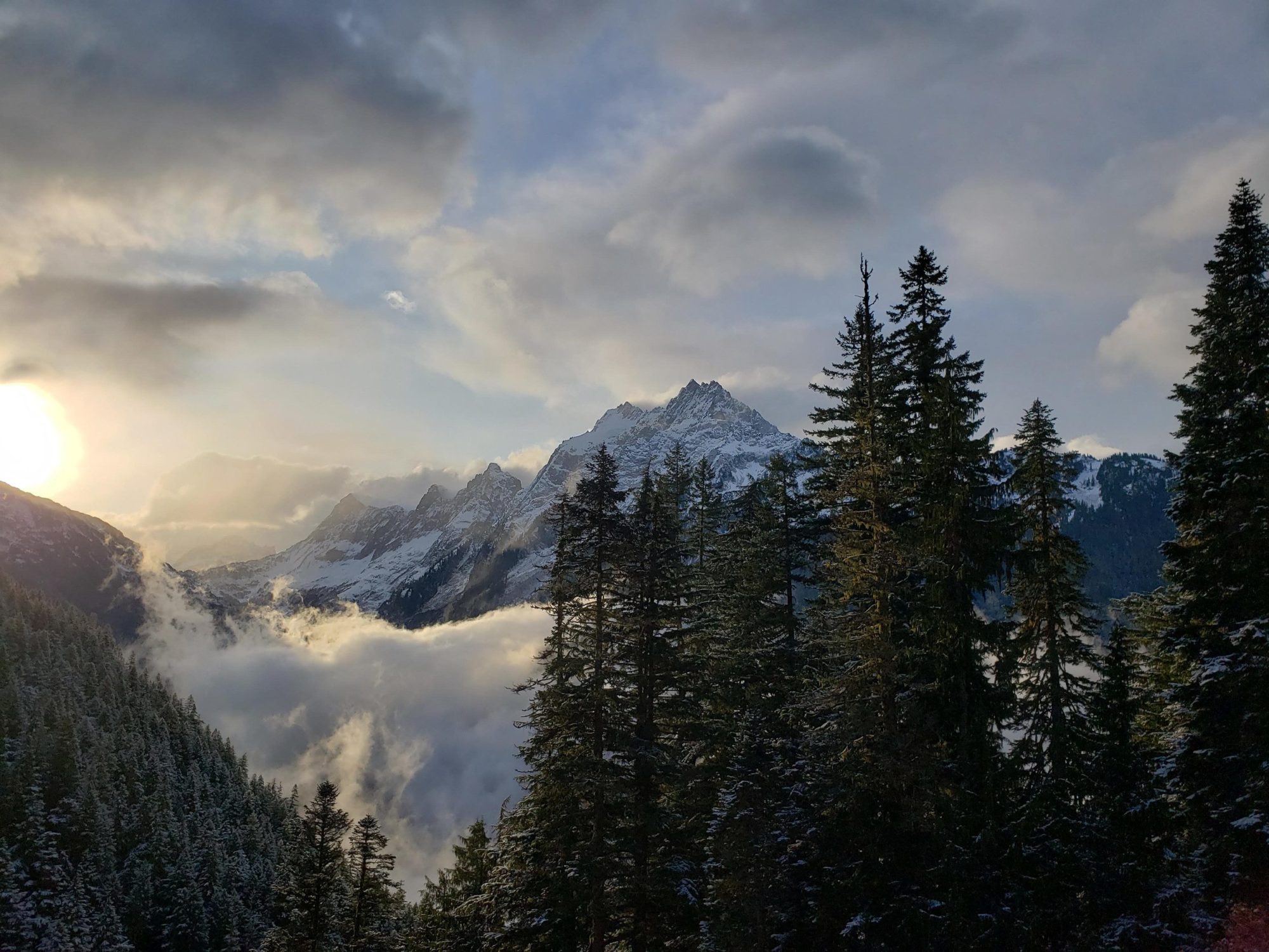
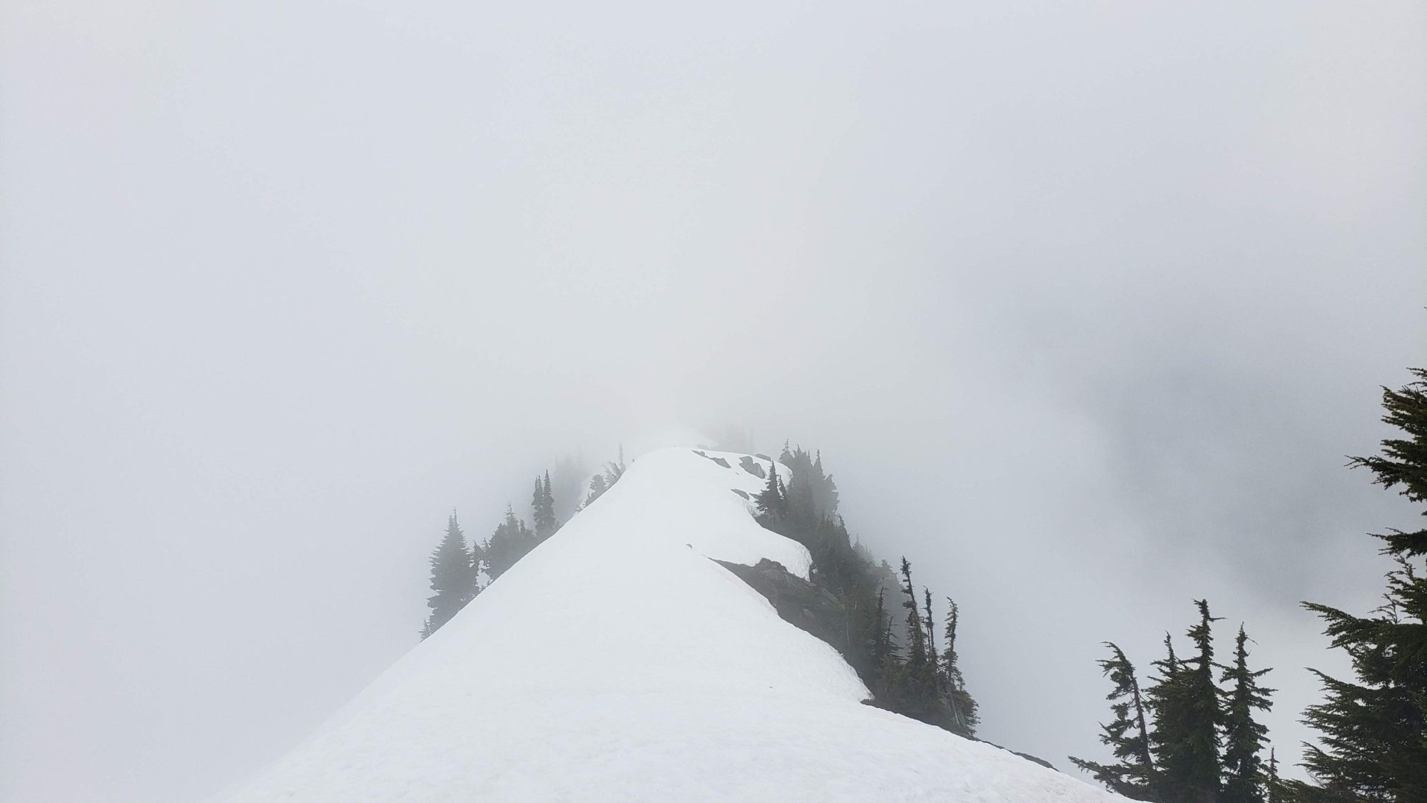
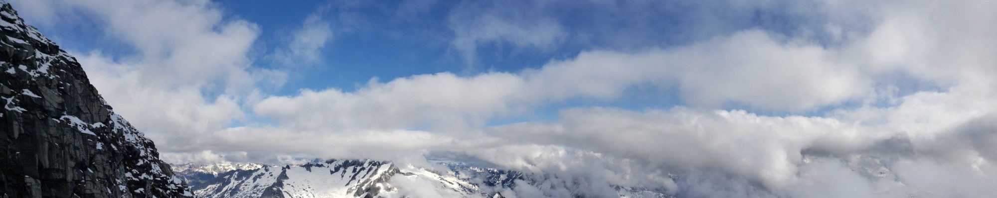
Until I reached the ridge that allows access to the Roush Basin at about 6,000 feet the post-holing continued. It was arduous and slow. At the same time as I was trying my best to focus on my steps a very different weather system was rolling in around me. In a matter of two hours the day went from partly sunny, to nearly whiteout conditions. At this point with the snow conditions my lack of snowshoes and the changing weather I decided it was best to head back. I spent time enjoying what view I could and then head back home. Eldorado peak is one I will be back for soon. I can’t wait to see what the knifes edge is like.
Check out my successful ascent of Eldorado Peak for the full beta.
After the last time I had attempted to climb Eldorado Peak, I knew how difficult the approach can be. With that in mind, I had made an ambitious plan to climb several other Bulgers (Klawatti and Austera) in the area at the same time. As luck would have it, the Cascade River road opened one day before I was planning to head out. I set off with confidence that the weather report would hold and I would make an incredible feat happen.
Summiting three peaks in this area of Washington is no small matter. Unlike my previous attempt, the winter storms had left me an easy crossing. From the parking area. To use it, head straight into the bushes. Once on the beach, head left and there is a large tree currently spanning the river. After some winter storms, this will undoubtedly change, but for now, it is a good crossing. Once on the other side, turn left and a faint trail through the bushes will bring you to the main “trail”.
There is another option available if you head left on the road from the parking area. Others said it is around 150 feet down the road, head toward the river and then there is a crossing. I cannot provide more detail since I did not use it. The trail for Eldorado peak is tough. The climbers trail through the woods will take a lot out of you, but, it is easy to follow to the boulder field.
Once at the boulder field, look for cairns and begin to enjoy the views as you climb ever more upward. Once above the first section of boulders ignore the multitude of cairns to climbers left. Instead, do your best to stay climbers right. There is much easier trails to follow most of the way.
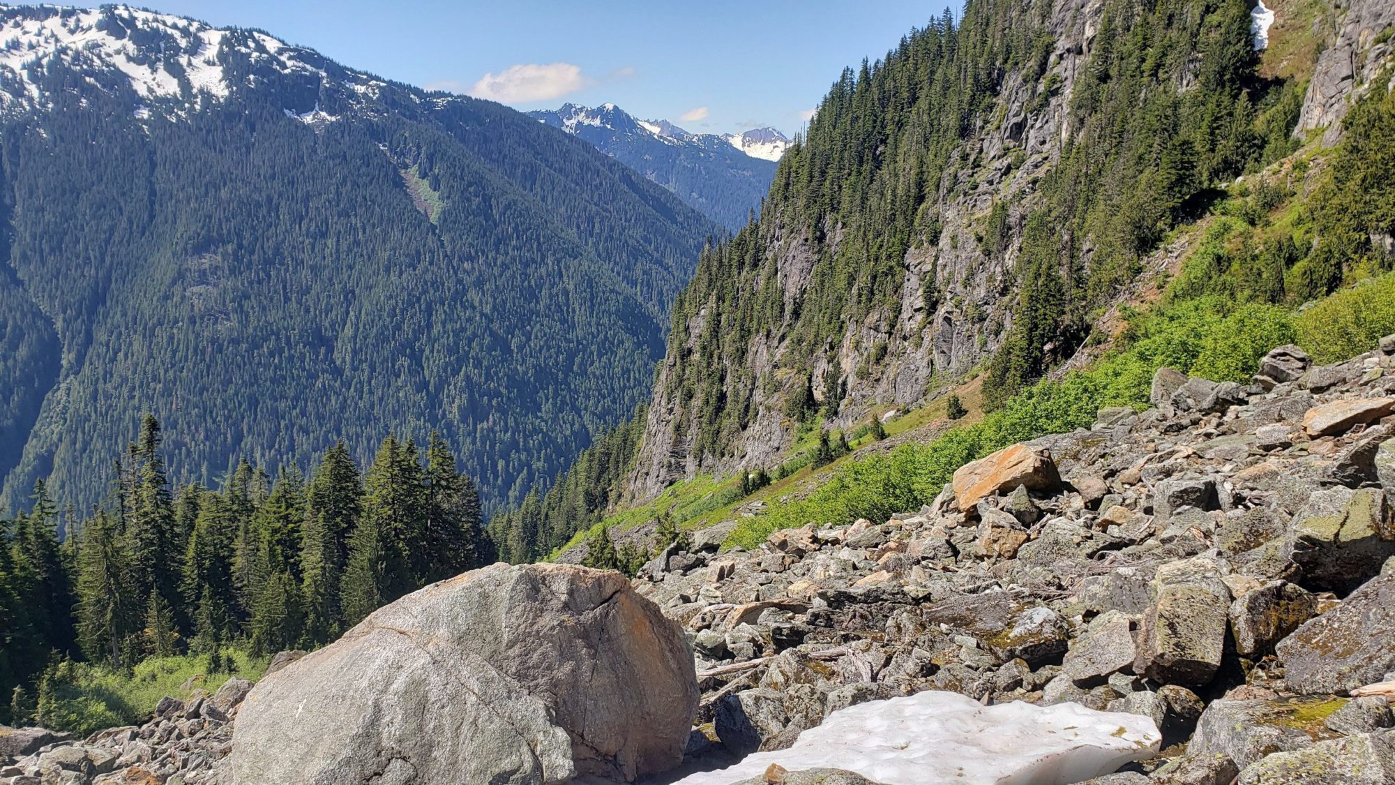
Follow the climber’s trail to the ridge line that provides access to the gully and your way down into the Roush basin. The gully should be easy to find and at the time of this writing is snow-free and easy to scramble down for the experienced.
Navigating the Roush basin is easy. Once at the bottom of the gully turn uphill and stay close to the climbers right on the glacier. Do not get too close to the cliffs as rockfall is common here. This is where my troubles for the trip began.
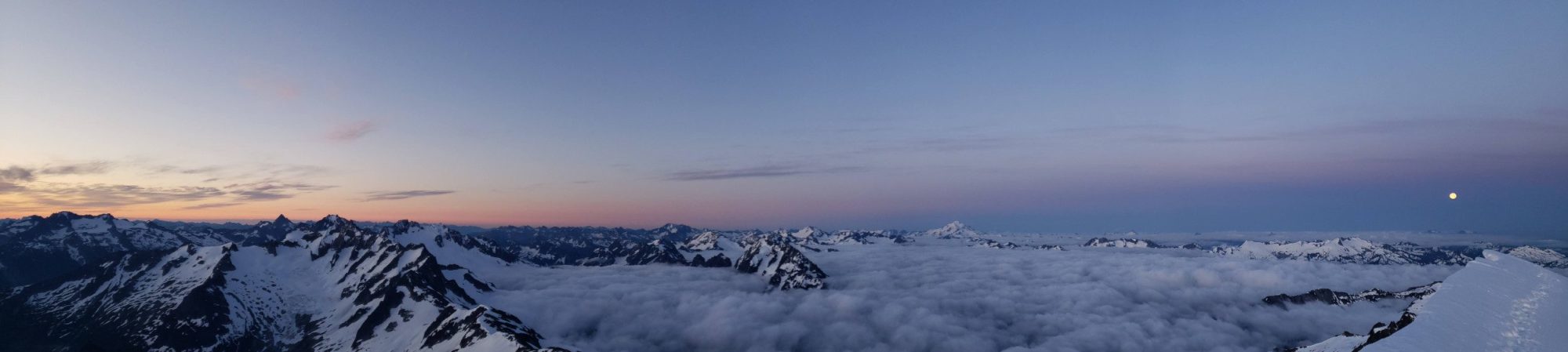
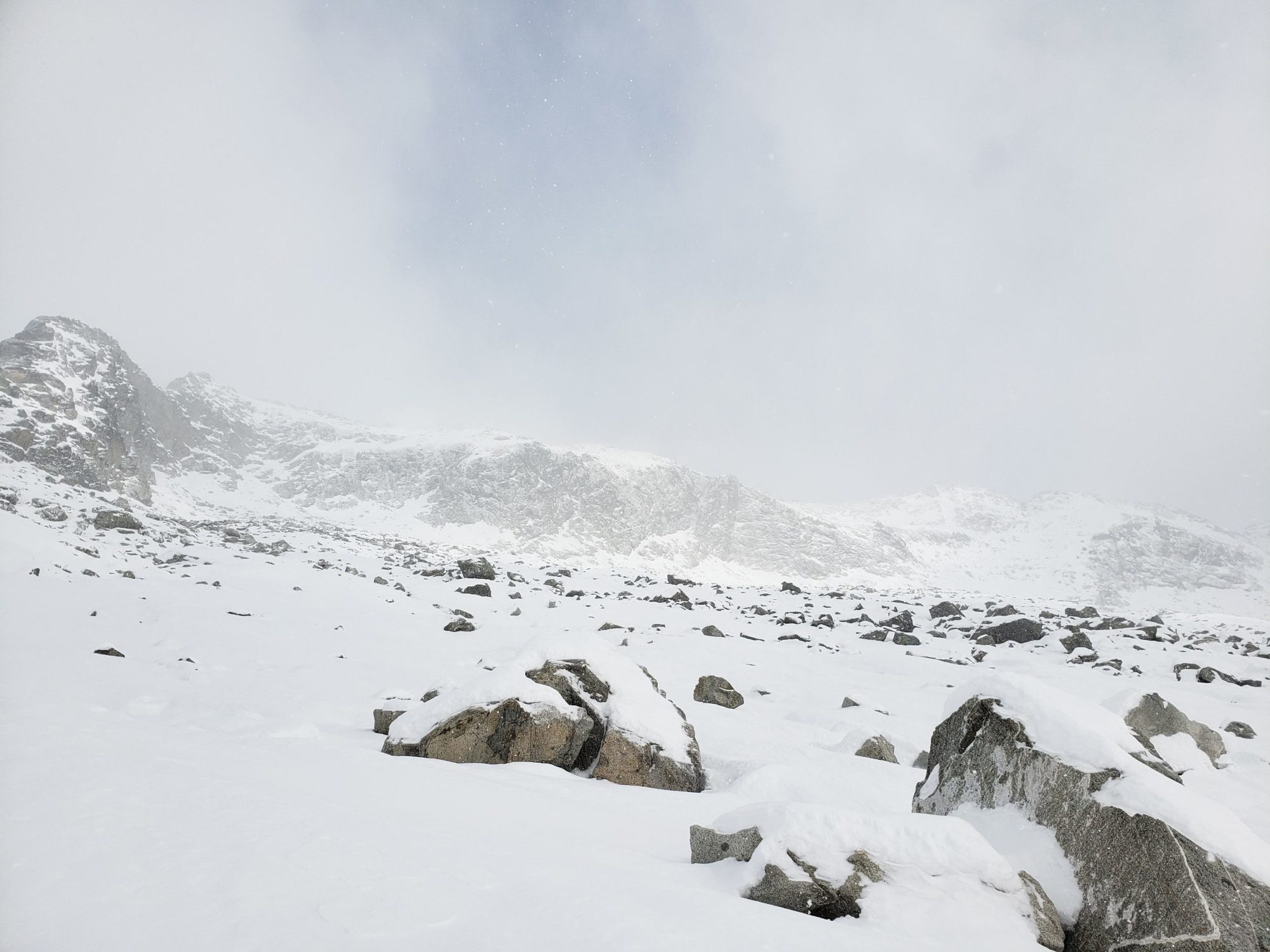
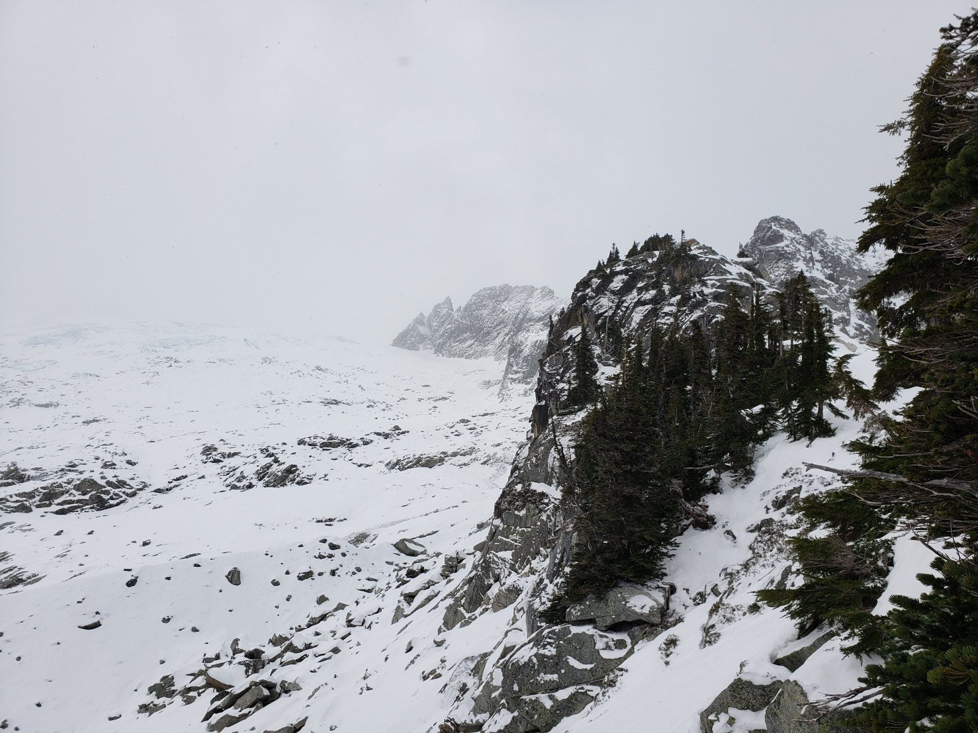
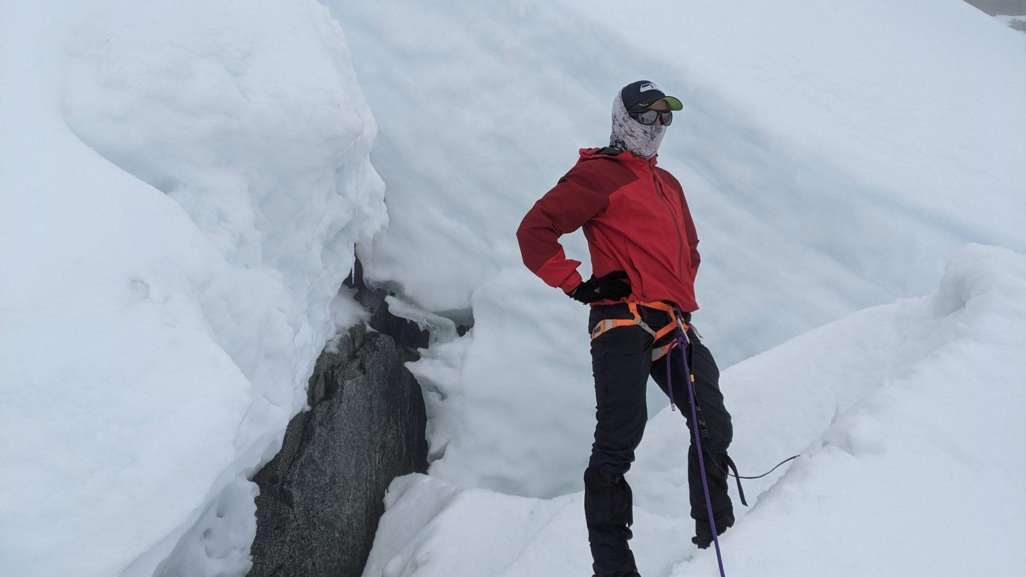
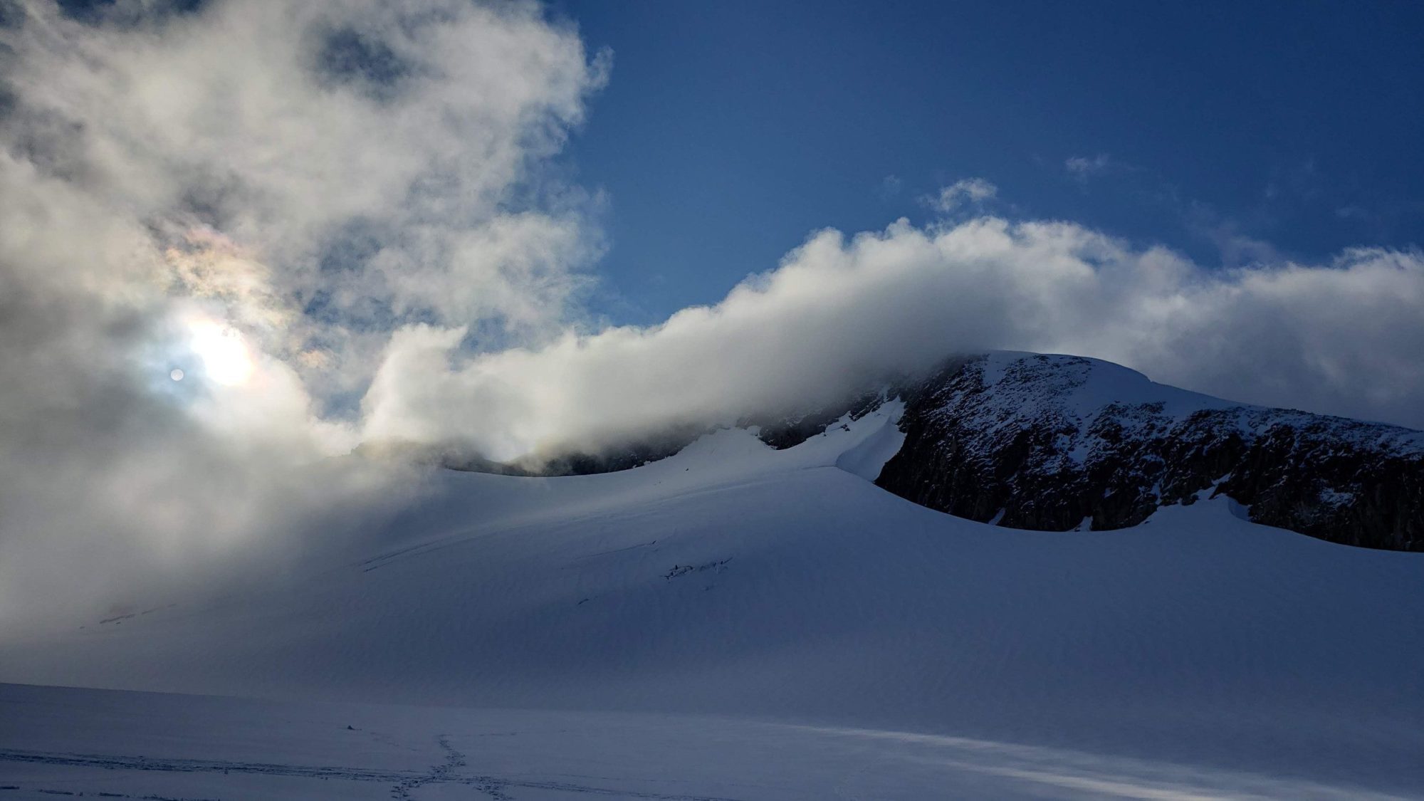
While the glacier walk is easy and currently crevasse free, a thick fog was filling the air. On top of that, the snow was getting extremely soft and I began to post-hole continuously. By the time I reached the inspiration glacier seeing over 20 feet was impossible.
I could not tell where I was going and knew that the first two peaks on my list for the day would be a no go. While frustrated I was okay with the fact that my main goal, Eldorado Peak, could still be possible for the next morning.

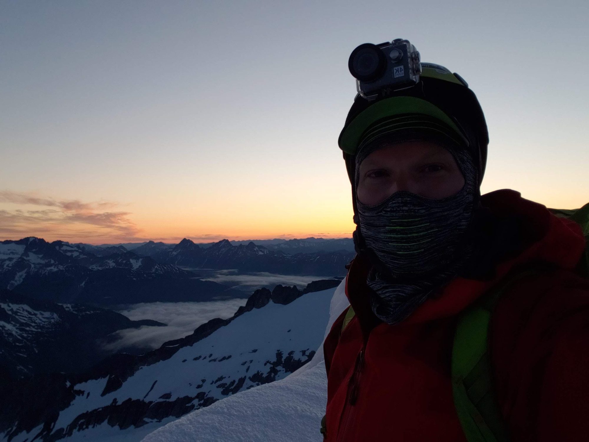
Before finding a good campsite and setting up for the evening, I chose to put on another layer of sunscreen. As I pulled apart my bag I realized that the sport sunscreen I use was missing. So I dug for my toiletries bag and found the bottle of store-brand SPF 50 I had also brought along. I don’t know if it was the cold, or if the altitude did it, but as I squirted it out it became clear the sunscreen had separated.
In my hand was a clear liquid with strange white dots in it. Immediately I knew this was not okay but still slathered it on in hopes of some protection. It failed and My face would end up cooked to a crisp.
As I was setting up my camp a nearby group of two others invited me to use the snow wall they had already built. Ecstatic to save myself some work, I headed over to their camp and set up my tent. It turned out the two of them had planned to climb the same peaks as me, but both of us got sidelined by the thick fog. After chatting for a bit, we all decided to head for a small notch that was nearby and climb it for fun and to waste some time.
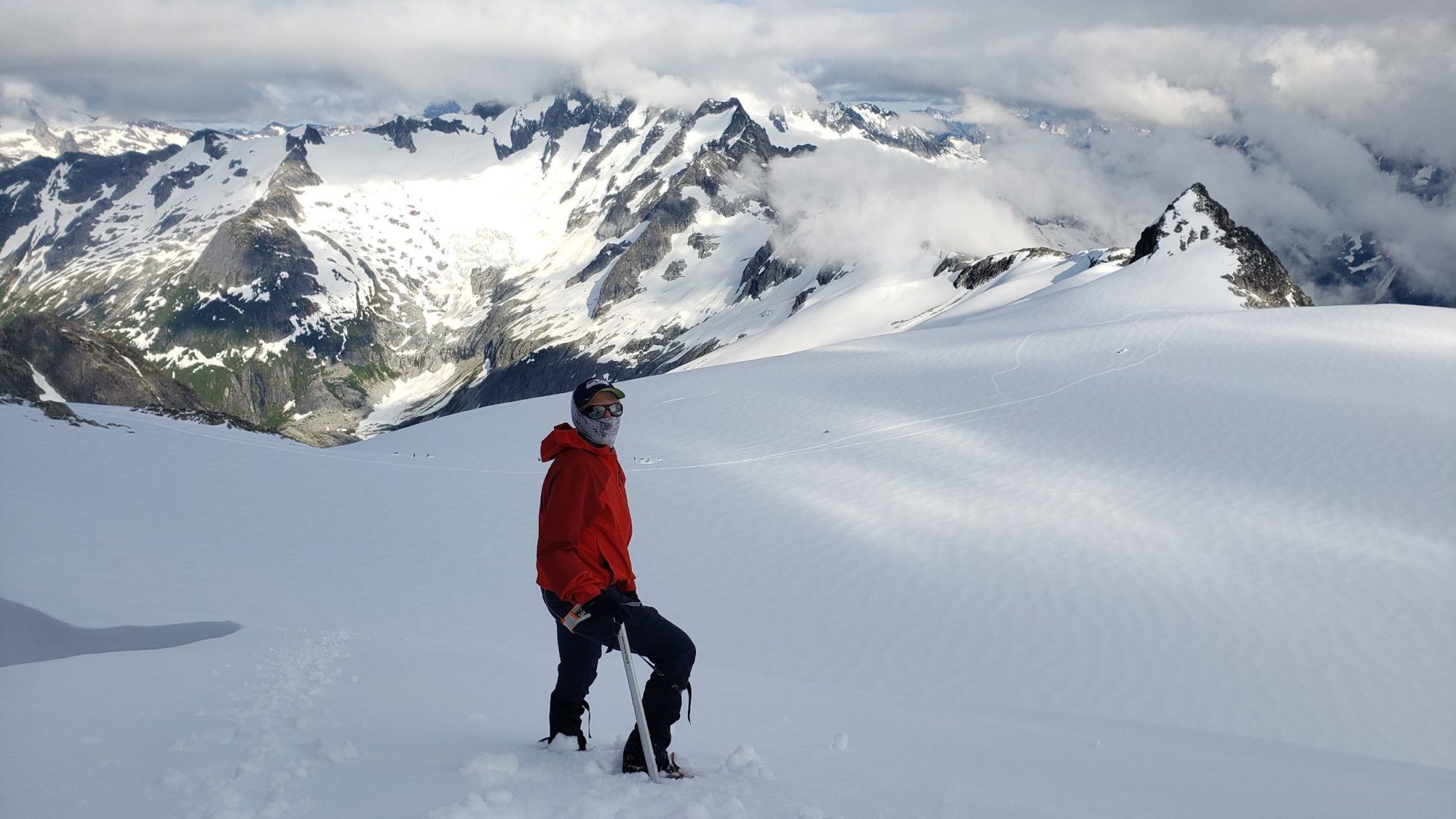
Afterwards, two of us headed off to explore the upper portions of the inspiration glacier. We nearly managed to find a small route up through a couloir to the summit of Eldorado Peak. We turned back a mere 600 ft from the summit due to weather conditions on the upper mountain.
We all hung out in camp for the evening. They lit off some fireworks for the fourth and we all watched as the weather cleared.
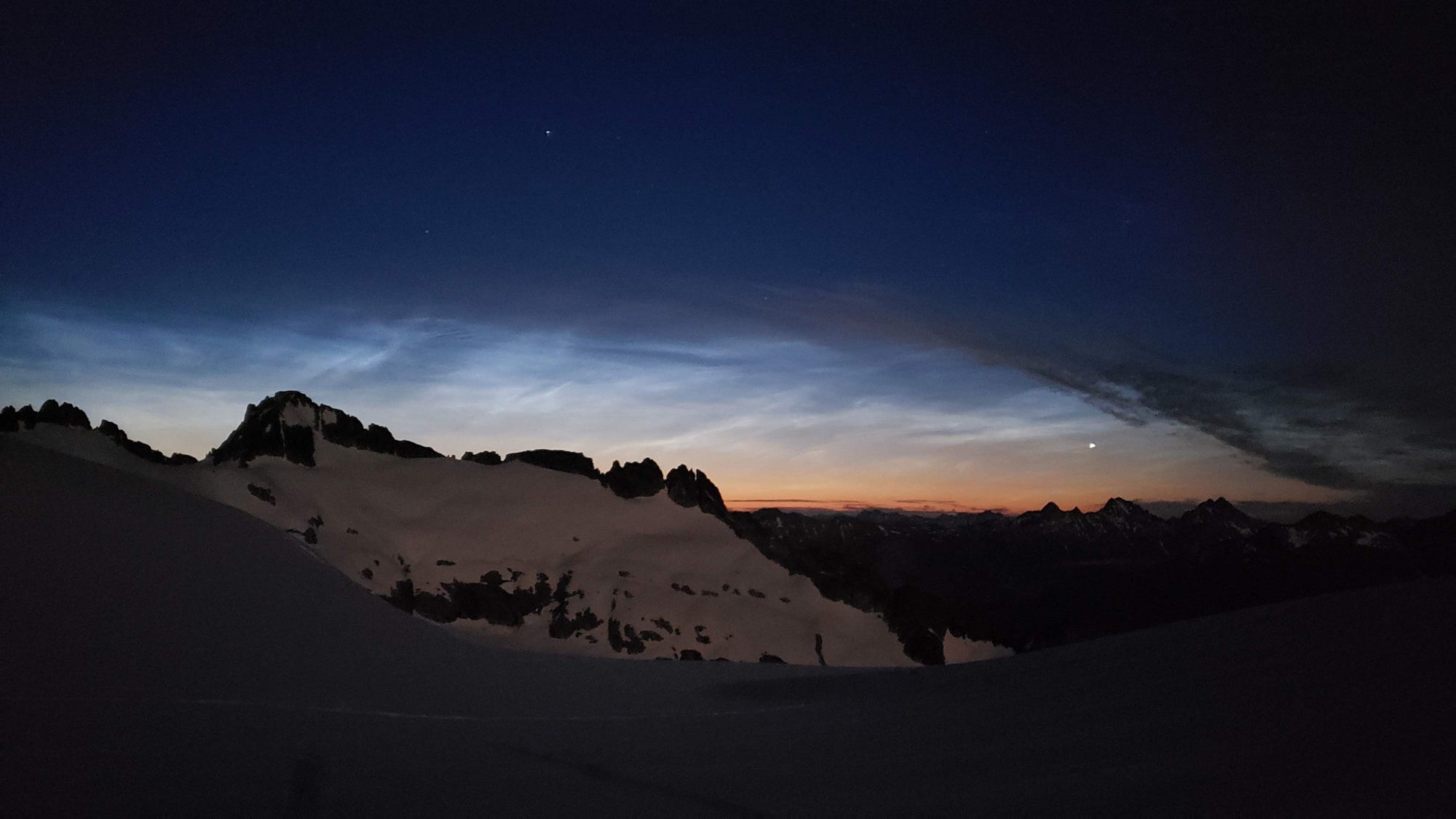
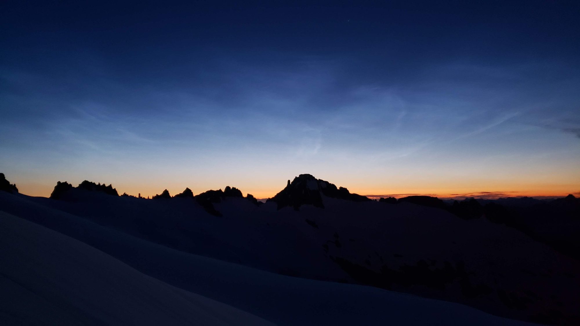
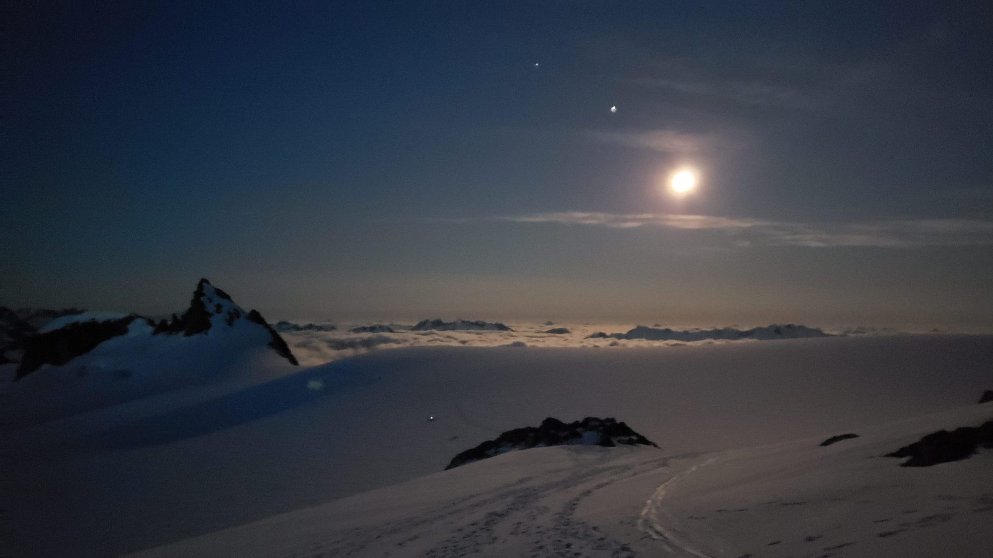
After debating the very soft snow conditions of the first day, I had decided to make my summit attempt around 3 am. My hope was that this would provide good solid snow, and if the weather report held, a clear sky and sunrise.
I ended up waking around 2:30 am, laid in my sleeping bag for a bit, ate 2 energy bars and then threw my gear on. I was on the trail by 3:30 am with a perfectly clear sky and moonlight bright enough to keep me from needing a headlamp.

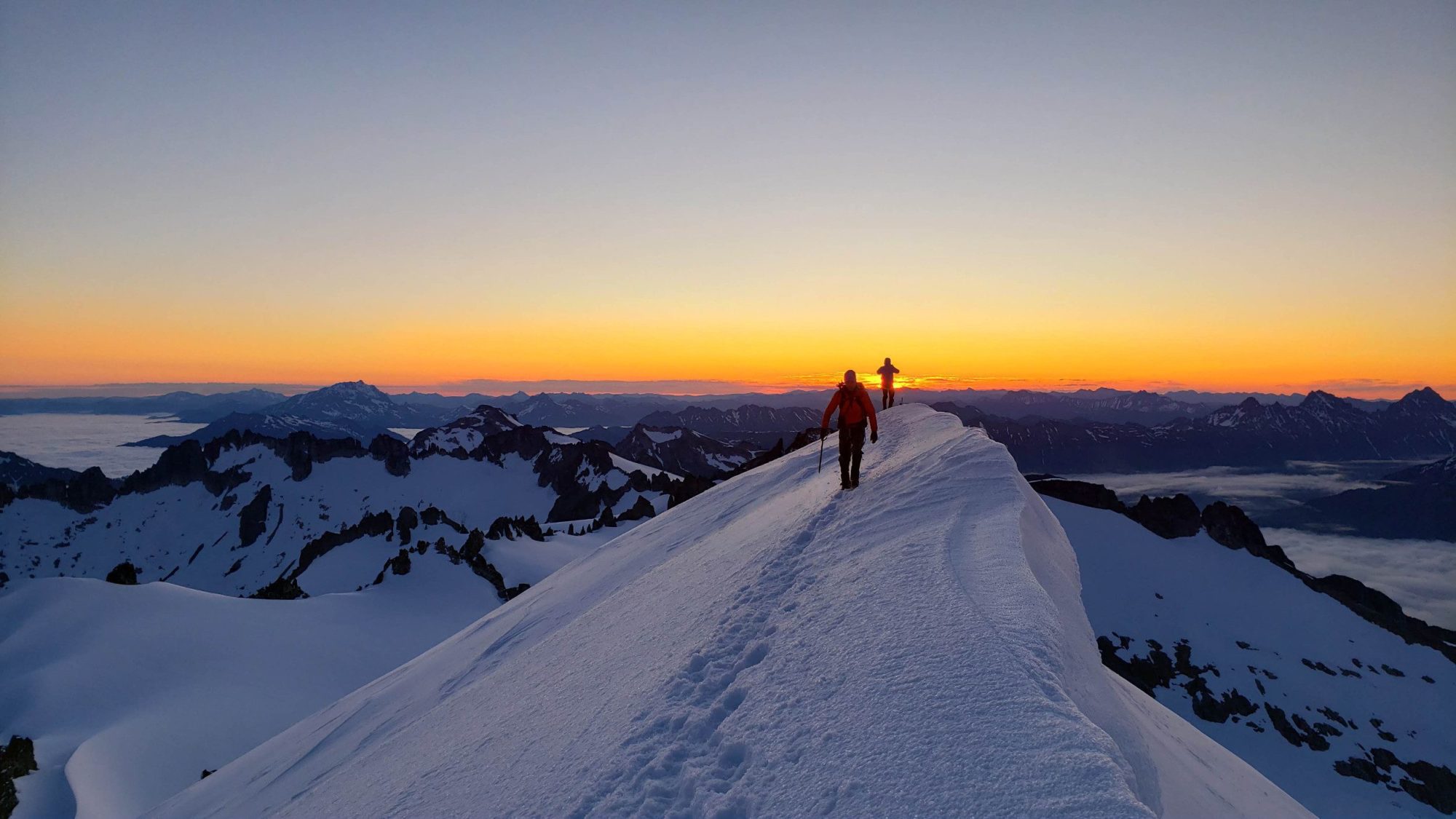
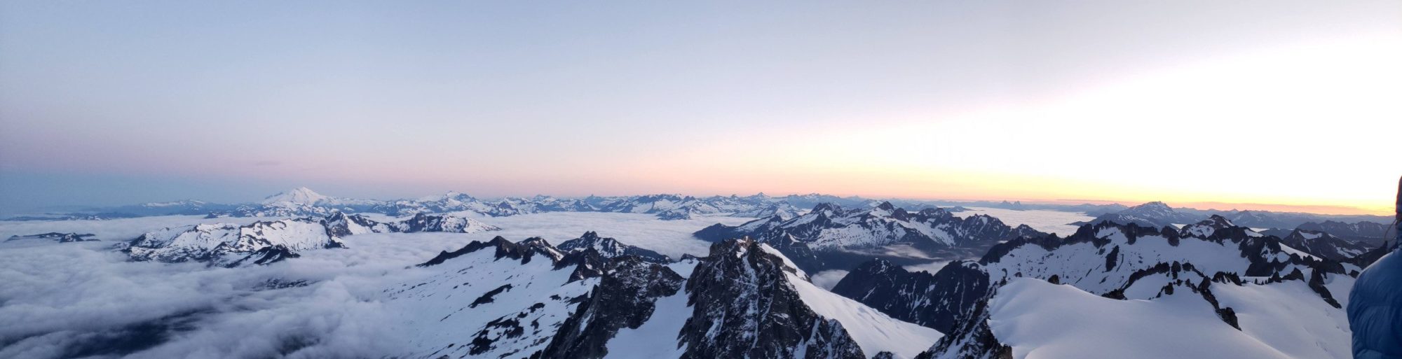
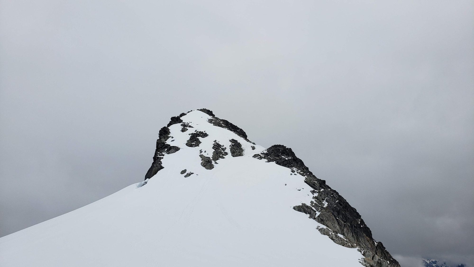
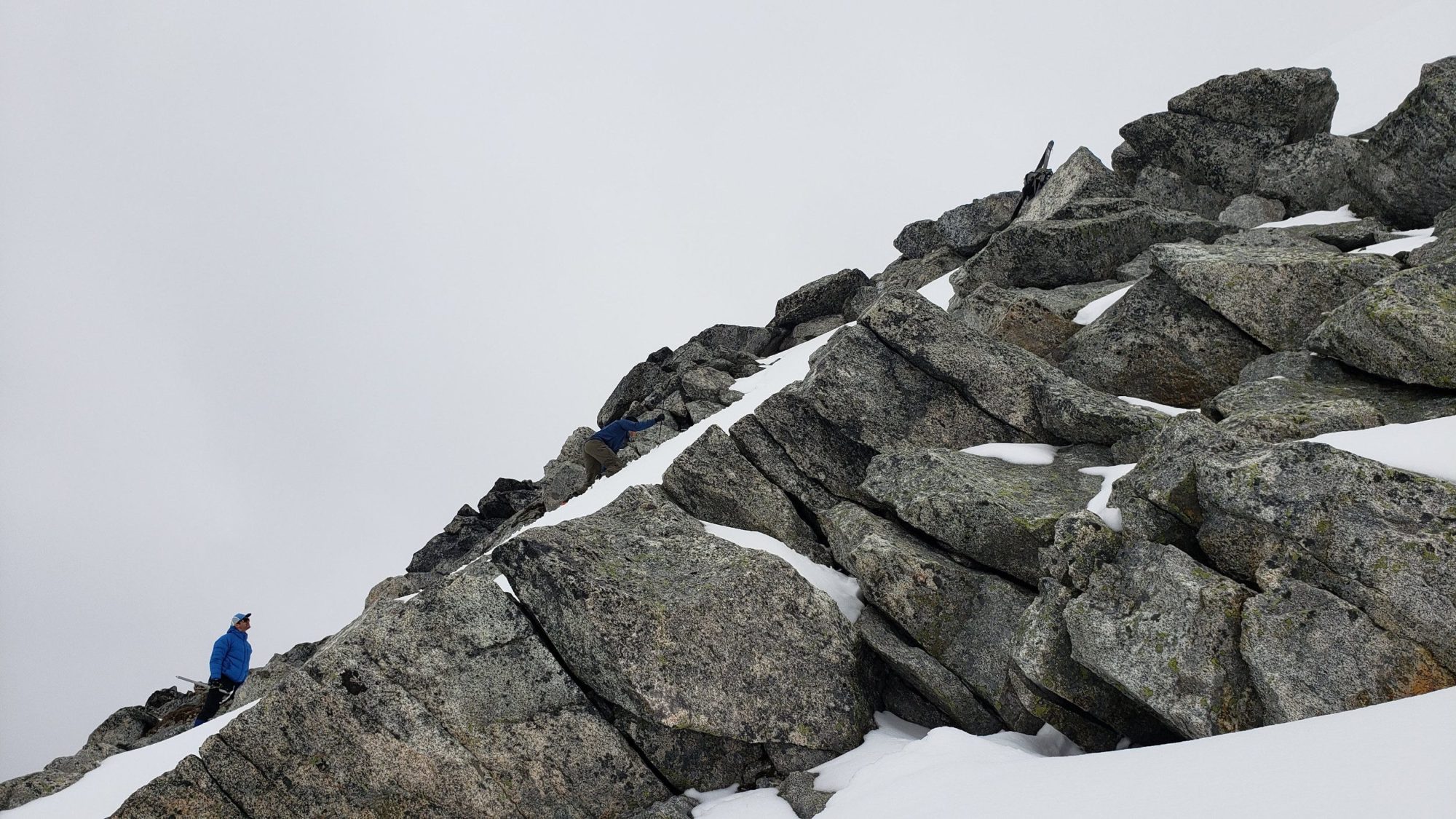
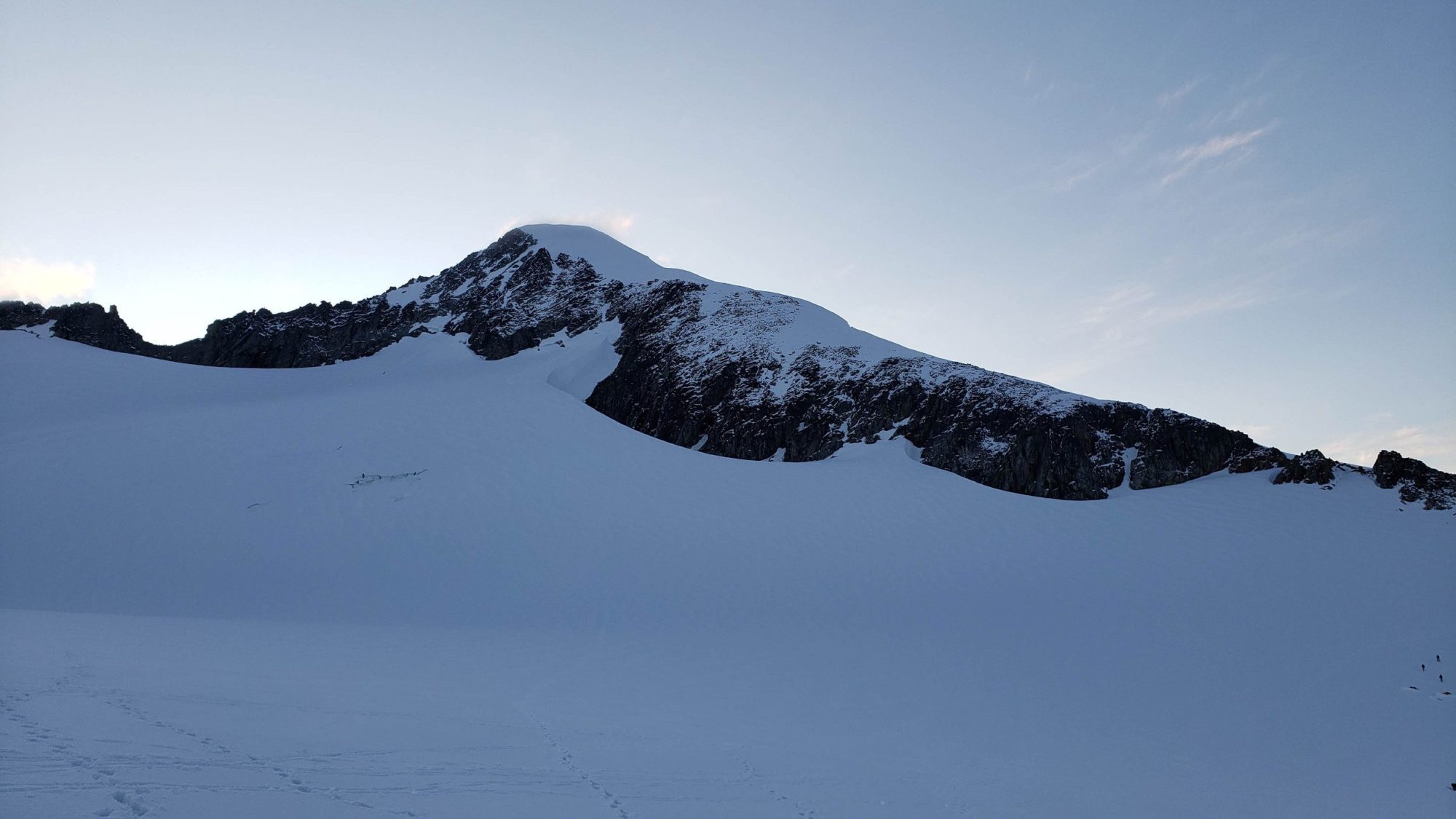
Once you have started the climb of Eldorado Peak, all you need to do is walk up to the ridge-line and follow it up from inspiration glacier. The route is pretty obvious and will most likely have many footprints to follow. At around 8600 feet you will reach the infamous Knifes Edge and the end of the climb.
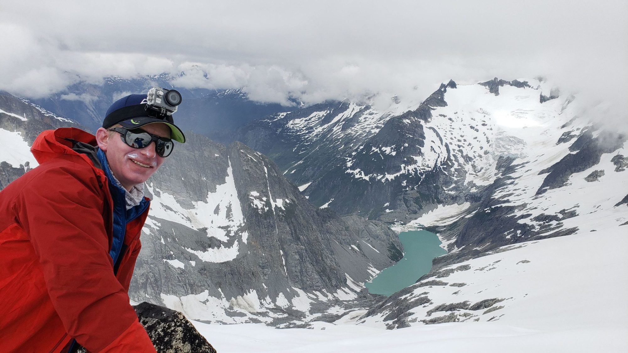
This is one of those climbs that I wish I could say more about. It is spectacular and has the feeling of a big mountain despite its “small” stature. The truth is some eye candy just feels more appropriate.
The hard part will begetting to Eldorado Peak. But, If you are looking for the a secluded big mountain feeling, go for Eldorado Peak. Try to be on the summit for sunrise, it will change your life.