Sauk mountain is supposed to be a fairly steep but straightforward climb during summer. From the trail map it looks like most strong hikers can take it on without much concern. But, I needed a strong early season training climb to get ready for the spring and summer climbing season. With the short days, this time of year Sauk mountain seemed like the perfect destination if I got an early start.
The road to the trailhead is covered in snow most of the winter. So if you plan to take it on beware that you will be doing at least a few miles of road walking. The grade is pretty even which allowed me to make quick work of it in snowshoes.
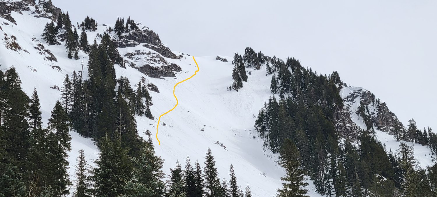
It is always hard to get a photograph that conveys how steep a slope is. But from the first time Sauk mountain comes into view, it is clear this is not just another day out. The main gully going up the peak has a steep grade and certainly gave me some pause. I had enough gear with me not to worry and so I continued on my track. If you choose to follow in my footsteps be sure to have enough ice tools for some mixed climbing.

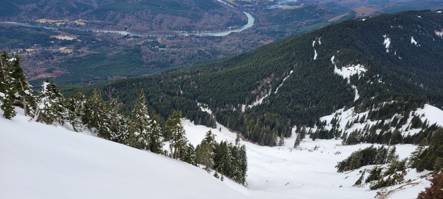
Even from the lower portion of the climb the views are fantastic. So if you choose to stop here you will still get a nice treat for the day.
The main slope up Sauk mountain does not really provide much room for side hilling or anything really other than going straight up the middle and heading for the main ridge. The drop off here is fairly freighting and the entire time I was making my way up I had to work on keeping my focus on the goal. Any fall here would surely result in serious injury at the least.
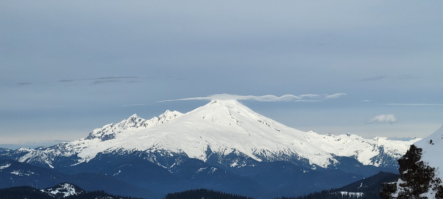
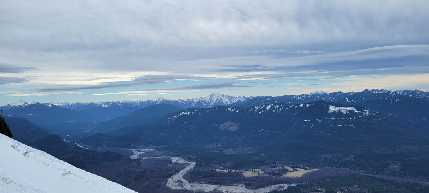
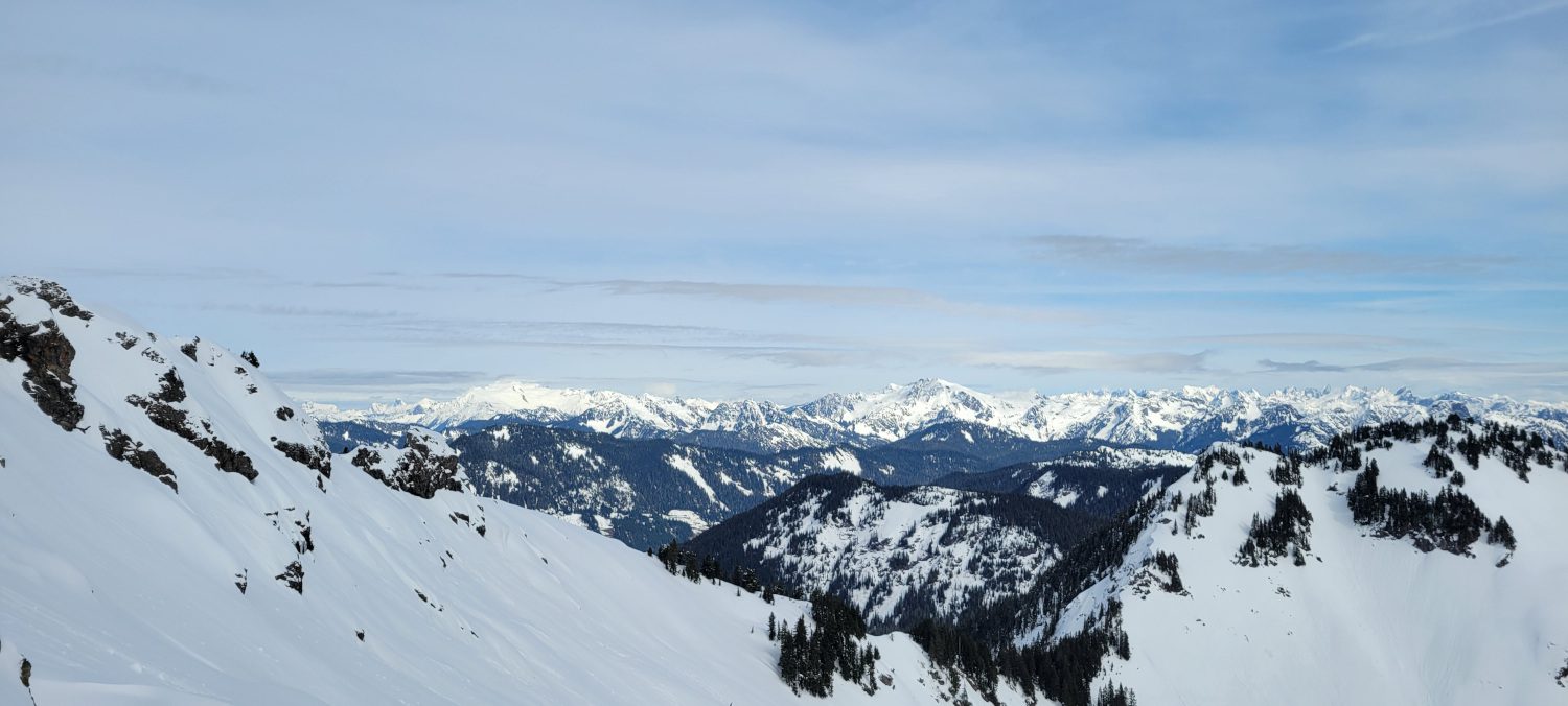
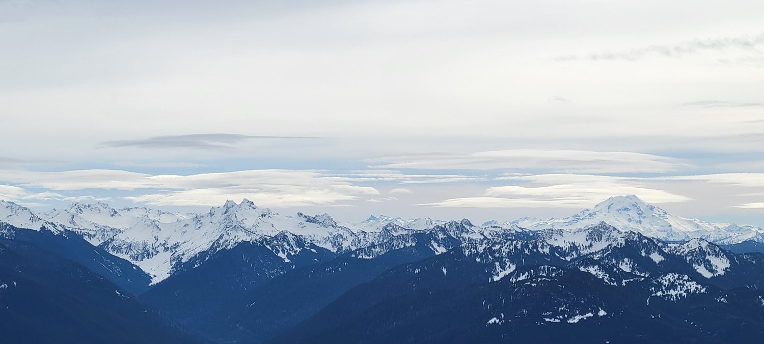
Once onto the main ridge the views only get better. Glacier peak rises high above the Monte Cristo area to the south east. The Pickett Range makes a quality impression to the north. The views of Mount baker only get better with every step towards the summit.
Much of the upper ridge is easy to navigate. Though there is a short section with a lot of exposure over a massive cliff that leads down to Sauk lake.
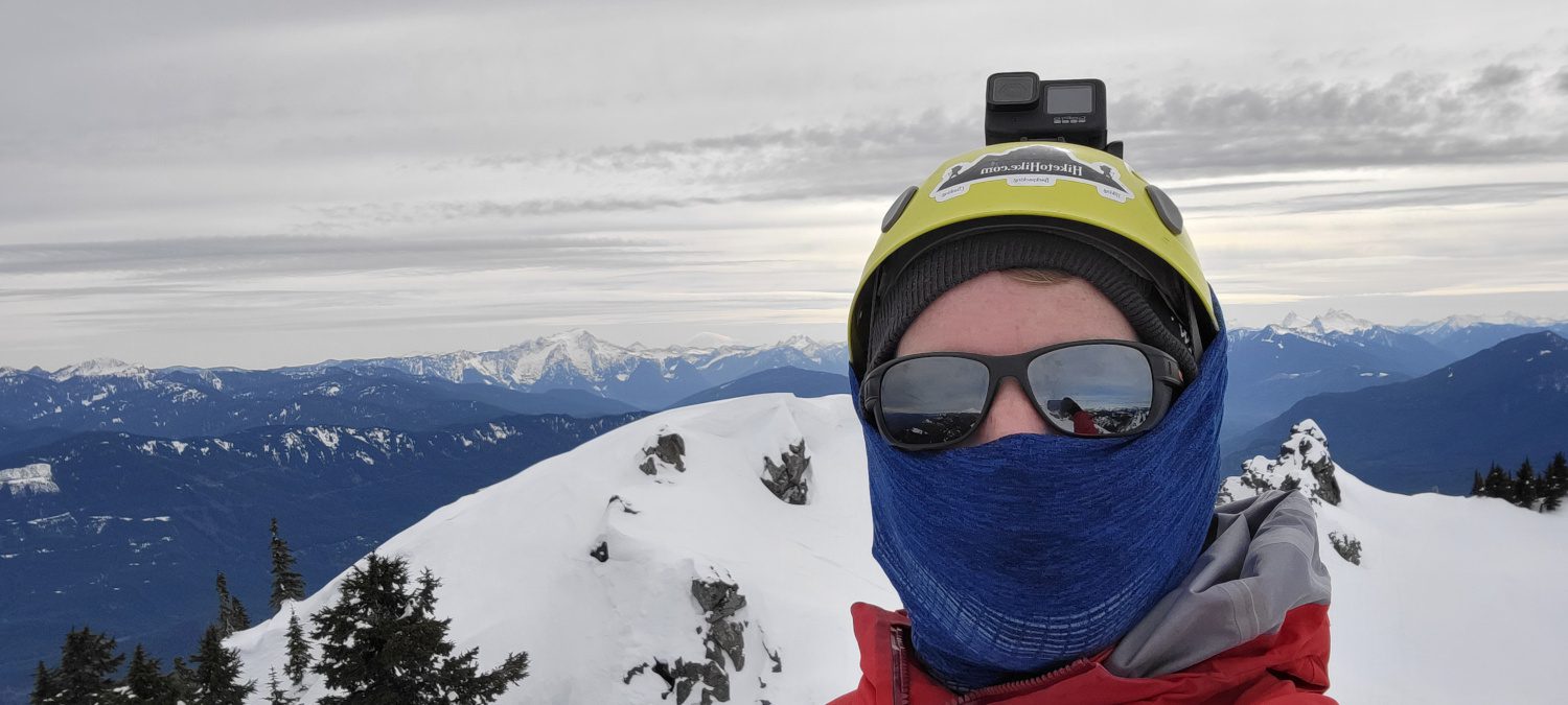
Making the summit was gratifying and the training provide for this coming seasons larger peaks was perfect. If you are looking for a bit tamer of a day out, try hiking Sauk mountain in the summer instead.